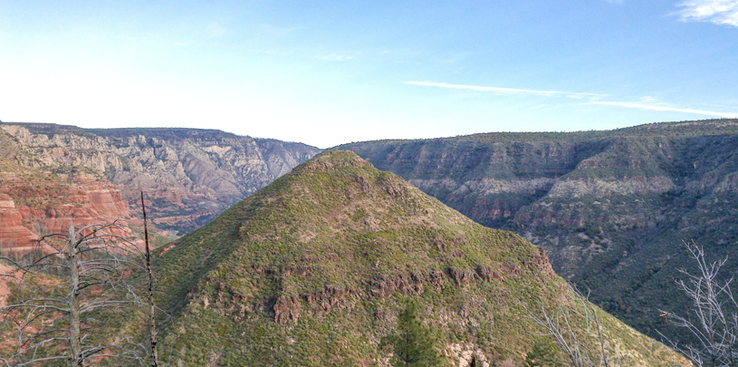
 by Ed Grumbine, North Rim Ranches Director
The southern edge of the Colorado Plateau is not hard to find. Head south from the pine forests of Flagstaff, Arizona and, before too long, you drop off over a crumpled break in the land known as the Mogollon Rim and find yourself in Sedona. You know you’re in a very different place when suddenly you’re surrounded by towering red rocks and 20 people are asking you why spindly ocotillo, an archetypical Sonoran Desert plant, is growing next to a Utah juniper.
These 20 curious souls had signed up for the first of several day hikes led by the Grand Canyon Trust and our partner, the Natural History Institute. Our common purpose was to explore how getting to know the plants, animals, and natural areas of the Colorado Plateau could help people advocate for protecting them. So, on a beautiful spring day in early April, I found myself leading a hike with the Natural History Institute’s Tom Fleischner along with hikers from Flagstaff, Phoenix, Prescott, and points in between.
"This is just about as far north as ocotillo can grow,” explained Tom, “and the same goes for Utah juniper, except that it’s at its southern range limit here. Ten thousand years ago, neither of these plants grew here — the climate was completely different.”
“Same for the rocks,” chimed in Kellen Shaver, our local geology expert. “Most of Sedona’s red rocks are part of the Schnebly Hill Formation and they were laid down when the climate around here was subtropical back about 290 million years ago, when this area was sand dunes on the coastal edge of the ancient Pedregosa Sea, way before North America even existed.”

A quiet descended on the group. “How old is Sedona anyway?” I asked.
The answer, of course, depends on what you choose to focus on. We can choose geologic time, or the time it takes for plants like ocotillo to evolve and move north from Mexico. Or we can narrow our spotlight to the people who lived here long before the first Anglos showed up, the Sinagua.
All of a sudden, a small hawk buzzed across the sky, circled once, and disappeared behind a red-rock spire. “Did you see that?” asked Tom. “Did you notice its size and how its wings were slightly swept back? That was a Cooper’s hawk, not a heavy-bodied red-tailed hawk. Cooper’s is built for speed and can take small birds and insects right out of the air.”
We settled in under the scant shade of piñon and juniper for lunch. Many of the people out hiking with us knew quite a bit about the Colorado Plateau, but few knew much about the biological and cultural richness of the Mogollon Highlands and the southern rim of the plateau.
 “Here’s another way to grasp why this place is important,” offered Tom, as he opened up a large map of the entire Southwest. “This shows you all the vegetation from Mexico up north beyond the plateau and all the way east over to Texas. You can see that more colors means more plant-community diversity, and look where we are — right in the heart of the most converging colors.”
It was time to go, but Tom’s map gave me a good follow-up idea. I pulled out a second map, this one showing all the public lands in and around Sedona and the Mogollon Rim.
If you overlaid all the ecological boundaries we’d explored that day with this map of our public lands, you could begin to see what is protected, what is private, and what the relationships are between the two.
“Yes, that hawk and those ocotillo need protected places to live, to continue to thrive,” Tom explained.
There was a bit more ground to cover as we headed into the deep green shade and bubbly-water songs along the banks of Oak Creek. And then we would dip into dry mesquite flats and slickrock along the path back to the trailhead. But the message was clear: there was more that all of us could do to keep the federal land management agencies focused on protecting this place.
As we said our goodbyes, Amy captured the feeling in our group: “This place has been added to the Grand Canyon as an area of special concern to me.”
As 2024 draws to a close, we look back at five maps we created this year that give us hope for 2025.
Read MoreA small victory in the legal case challenging Daneros uranium mine, near Bears Ears National Monument.
Read MoreMugs, handmade soaps, high fashion, jewelry and more. There's something for everyone on your holiday shopping list.
Read More