A look back at five maps we created in 2024 that give us hope for 2025.
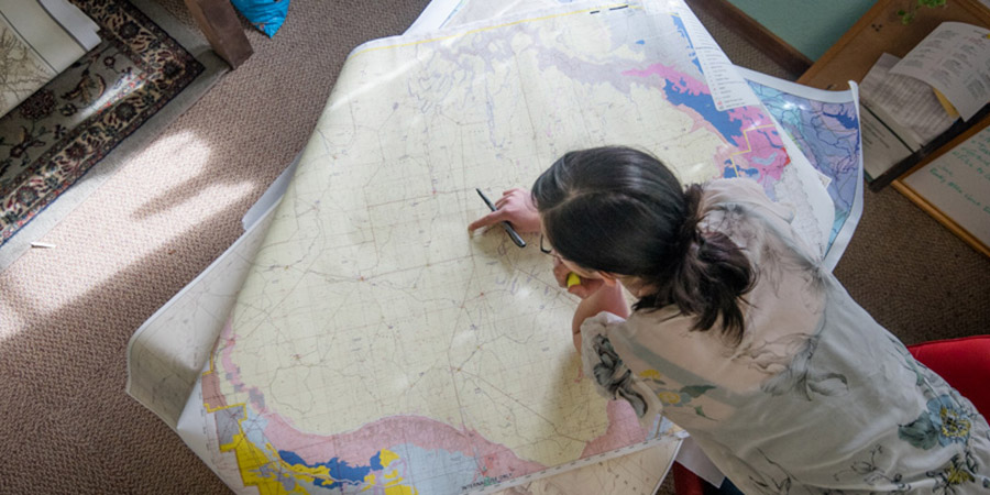
I love maps. But making maps is just a small part of what we do in the geographic information systems (GIS) department at the Grand Canyon Trust. Most of the time we’re behind the scenes, crunching numbers, analyzing data, and using cartography to help Grand Canyon Trust staff and our partners better understand the lands, waters, plants, animals, and people of the Colorado Plateau and make smart, science-based decisions. Many of the maps we create never make it to our website.
As the year draws to a close, the mapmaker in me wants to take a moment to highlight five very different maps the Grand Canyon Trust created in 2024 that are near and dear to my heart. Though sometimes about hard subjects, these maps and the work they support fill me with hope as we roll up our map-making sleeves in 2025.
1. The Colorado Plateau map, 2024 edition

Always a crowd favorite, the Colorado Plateau map illustrates public lands and tribal lands across northern Arizona, southern Utah, southwest Colorado, and northwest New Mexico. It was a joy to create the 2024 edition, which includes for the very first time Baaj Nwaavjo I’tah Kukveni – Ancestral Footprints of the Grand Canyon National Monument (abbreviated BNIK on the map), designated August 8, 2023.
The new monument protects nearly 1 million acres of ancestral homelands around Grand Canyon National Park. A coalition of Native American tribes with strong cultural connections to the area advocated for monument protections for years, and it’s incredible to finally be able to put their hard work on the map — literally.
2. Pinyon Plain Mine uranium transportation route map
Download the PDF of the Pinyon Plain Mine uranium transportation route map ›
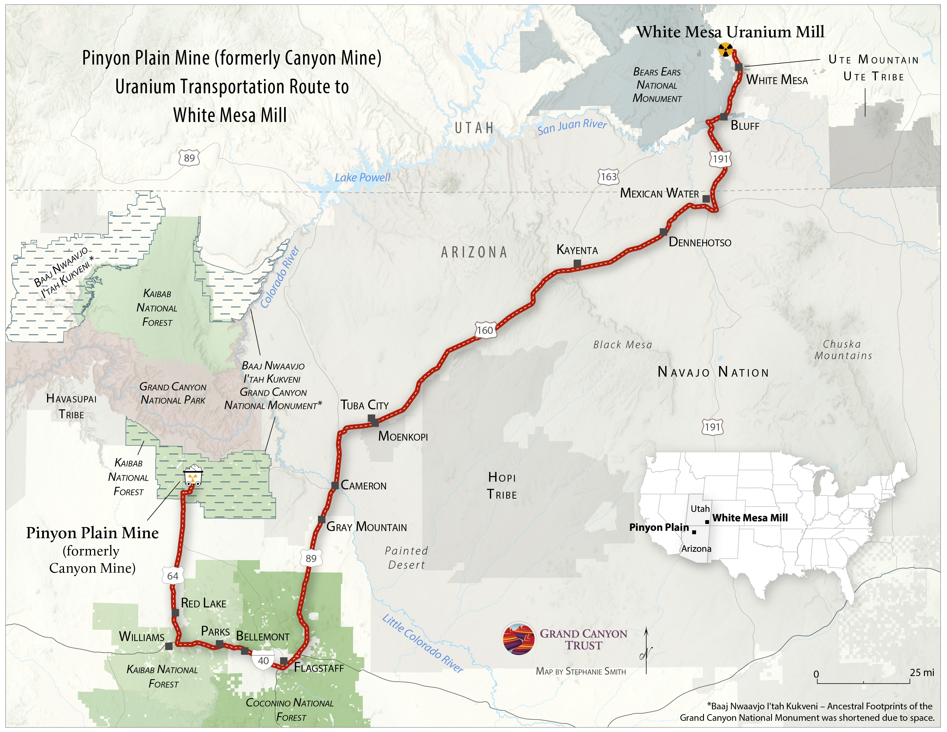
Our most widely shared map of 2024 was this map of the transportation route uranium haul trucks travel from the controversial Pinyon Plain Mine (formerly Canyon Mine) near Grand Canyon National Park to the White Mesa Mill, where the uranium is processed. More than 100,000 people viewed this map on social media, and thousands shared it. More than 18,000 signed a petition opposing the mine.
The Navajo Nation opposes uranium transport across its lands, and hauling is currently paused, pending negotiations with the mine’s owner. Meanwhile, Arizona’s governor, attorney general, and groundwater scientists who study the region are all calling for a review of the mine. It gives me hope to see tribes, state officials, and scientists working to keep lands, waters, and people safe from uranium contamination.
While on the surface this map might seem more scary than it does hopeful, when I look at it I remember all the people along the haul route who are standing up to protect their communities from uranium contamination, from Flagstaff to the Navajo Nation all the way to the Ute Mountain Ute community in White Mesa, who in 2024 rallied on the capitol steps in Salt Lake City and led their annual spiritual walk to protest the White Mesa uranium mill, drawing supporters from across the Four Corners and beyond.
Their advocacy gives me hope for the coming year.
3. Dams proposed on the Navajo Nation map
Download a PDF of the pumped storage hydroelectric projects proposed on the Navajo Nation map ›
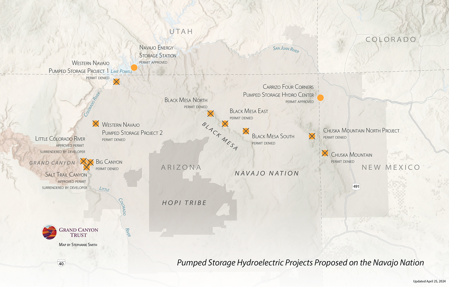
The first version of this map I made showed dam proposals on tribal lands, including many that tribes strongly opposed. So it was wonderful to be able to update this version and add the X’s to mark dam applications that had been denied, following a new policy by the Federal Energy Regulatory Commission that states the commission will not approve preliminary permits for hydroelectric projects on tribal lands without consent from the tribe on whose lands the project would be built.
Unwanted projects on Black Mesa and in Big Canyon, a tributary canyon to the Little Colorado River Gorge, were also denied, in a big win for tribal sovereignty.
4. Little Colorado River Agricultural Cooperative map
View in full screen (suggested for mobile)
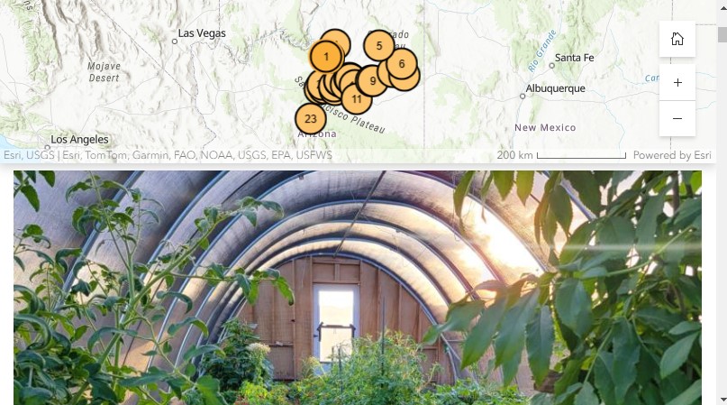
Is there anything more hopeful than a flourishing garden? One of the most hope-filled, nutritious, and delicious maps we helped create in 2024 was this interactive story map, produced in collaboration with the Little Colorado River Agricultural Cooperative.
The map spotlights nearly two dozen Indigenous farms and introduces you to some of the hardworking gardeners and farmers who make up this collective of over 40 Diné and Hopi backyard farmers, traditional farmers, livestock owners, and market gardeners from the Little Colorado River region. You can zoom in to learn what they grow and where. But just as important is the why; their stories are filled with passion for carrying on tradition, feeding their communities, and transforming food systems.
From the two-acre Red Earth Gardens in Ganado, on the Navajo Nation, where Felix Earle specializes in black diamond watermelons, chocolate cherry tomatoes, and scrumptious Japanese jade cucumbers, to the 0.6-acre Three Sisters Bean Farm, where Shonri Begay specializes in heirloom beans as a way to inspire seed saving and celebrate ancestral foodways, farmers across the region are doing their part to bring healthy foods to their communities, support food sovereignty, and build sustainable food economies by serving as a food hub and a breadbasket for the region.
5. 2024 Volunteer season highlights map
View in full screen (suggested for mobile)
All maps tell stories, and some of the most hopeful and joyful stories of the Grand Canyon Trust’s work come from our volunteers. In 2024, over 250 people contributed nearly 2,000 hours to restoration and research projects across the Colorado Plateau. Volunteers rolled up their sleeves and helped build human-made beaver dams to restore wetlands in Utah — and once the dams were built, the beaver moved in!
Volunteer projects remind us that whatever is happening in Washington D.C., the good work of protecting and restoring the Colorado Plateau is moving ahead, with many pairs of helping hands replacing strands of barbed wire with smooth wire so that pronghorn can roam across the landscape freely, building rock structures to help streams, or pulling invasive weeds so that native plants and the creatures that depend on them can flourish.
There’s so much to be hopeful about here on the plateau in 2025. If you need a dose of hope, sign up for volunteer updates, and join us in the field next season.

