by Erin Lees, Intern, North Rim Ranches
The grass moved and swayed in the wind, I could almost feel the breeze. A bird would fly to the tree and perch on the creaking branch but in the next slide, it would disappear. I would again watch the grass perform its interpretive dance while I sat in my chair and watched. Hours went by without documenting a single animal. I would reluctantly file “blank” in hundreds of slots in the Excel spreadsheet. One location, nothing. The next location, nothing. I watched more tumble weeds roll by the camera and the tedious work would start to pull my eyelids down but suddenly a figure would appear in the screen. At times it would be a single bighorn sheep or even a group of pronghorn. But, I thought, could it be our target species?
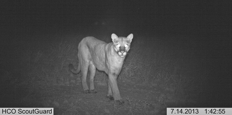
Emerge the mountain lion. A statuesque, elegant, and lively animal was standing in front of me with only a computer screen between us. I could almost feel the warm breath against my skin. The puma seemed noble and wise moving its body weight from one shoulder blade to the next as it pursued its target of attack. One photo it would be present, the next it would vanish. For that brief moment in time, the mountain lion’s majestic spirit appeared through the camera lens. I was very curious as to where it was going. It could be searching for food, for its cubs, finding a new population, retreating from poor habitat; the answers are endless.
Tediously sifting through mountains of pictures, it is easy to lose sight on what we are trying to achieve. These photos came from motion-activated camera “traps” that were placed in areas within the Kane and Two Mile Ranches in northern Arizona predicted to be “high traffic” for a number of wildlife species including the noble puma. Each photo is cataloged according to the location and species (or lack thereof) that appears. We are essentially asking whether we are finding animals in the places our sophisticated statistical models of habitat connectivity suggest they should be. Along the way, we are also learning a great deal about the habitat requirements of many animals that call the Kane and Two Mile Ranches their home.
It is crucial to understand the effects that landscape form and infrastructure, such as roads, have on the movement of species and how possible “islands” connect to other populations. The pictures from this camera trap data are doing just that. It gives organizations like ours the ability to better understand the habitat in order to be aware of potential isolated populations and address fragmented areas. You know what they say, a picture is worth a thousand words.
As 2024 draws to a close, we look back at five maps we created this year that give us hope for 2025.
Read MoreA small victory in the legal case challenging Daneros uranium mine, near Bears Ears National Monument.
Read MoreMugs, handmade soaps, high fashion, jewelry and more. There's something for everyone on your holiday shopping list.
Read More