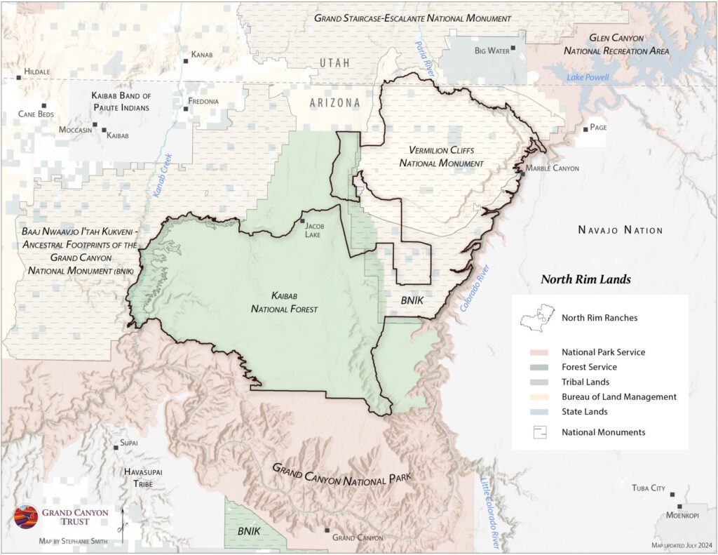
This map shows land ownership north of the Grand Canyon in Arizona and Utah. Download the map
Across 830,000 acres on the north rim of the Grand Canyon, the Grand Canyon Trust, in collaboration with a ranching family, federal and state agencies, universities, and hundreds of volunteers, is leading efforts to improve the health of the landscape. As the livestock grazing permittee of North Rim Ranches, we strive to be stewards of this landscape by limiting the amount of grazing that occurs here. Learn more about North Rim Ranches.
Maps and graphs may be used for non-commercial purposes provided that they are not altered or edited and they are appropriately credited.
All map products should be credited to Stephanie Smith, Grand Canyon Trust, unless otherwise noted. A hyperlink to the Grand Canyon Trust website is appreciated.
For higher quality images or custom sizing please contact our communications director, Ashley Davidson, at adavidson@grandcanyontrust.org


