 by Ellen Heyn, Communications Associate
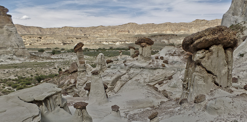
Covering more than 130,000 square miles, the Colorado Plateau is larger than every state but Alaska, Texas, California, and Montana. And with landforms like grabens, goblins, swells, and synclines, the plateau is as close to sci-fi as real nature comes. Its horizontal sedimentary layers have been thrust up in folds, punctuated by volcanic mountains, and spliced into deep canyons. But major mountain ranges and cliffs in each of the cardinal directions bound what we call the Colorado Plateau.
Come along to experience the the distinct character of each of the plateau's boundaries.

The Uinta Mountains stand about 50 miles east of Salt Lake City and serve as the northern boundary for the Colorado Plateau. Unlike most mountain ranges in the United States, the Uintas run west-east instead of north-south. This mountain range contains the highest point in Utah (Kings Peak: 13,528 feet), as well as thousands of miles of trails, small fishing lakes, and endless adventures. The south and east sides of the range are considered to be part of the Colorado River watershed, with tributaries of the Green River starting high in the mountains.
Lofty Lake Loop: The Uinta Mountains offer excellent summertime hiking given their high elevation. Lofty Lake Loop is a pleasant walk through a high forest that dips down into a meadow, climbs past several alpine lakes to a saddle, drops off the side of a ridge, and descends as you loop back to the trailhead.

Locals refer to the Mogollon Rim as the “edge of the world,” a name that aptly describes the 200-mile-long escarpment across central Arizona that defines the southern boundary of the Colorado Plateau. Here, you find the largest ponderosa pine forest in North America, which stretches from Flagstaff, Arizona to the White Mountains in the eastern part of the state. From around 7,000 feet elevation, the Mogollon Rim drops thousands of feet through bands of limestone and sandstone cliffs to Sedona and the Verde Valley before the saguaros welcome you into the Sonoran Desert with their waving arms.
Bear Mountain: A steep climb across a series of benches to the top of Bear Mountain matches challenges with rewards – let the panoramic views soothe your calf muscles, and check another Sedona mountain off your list. The redrock views imrove with every step!

The eastern boundary of the Colorado Plateau juts up against (but does not include) the San Juan Mountains, which were thrust up as tectonic forces formed the Rocky Mountains. Cultural sites abound, including Mesa Verde National Park, Hovenweep National Monument, Canyons of the Ancients National Monuments, Chaco Canyon, and many others.
Sand Canyon Trail: This loop hike in Canyons of the Ancients National Monument passes cliff dwellings, a large natural arch, and colorful rock formations, and features great views of Sleeping Ute Mountain and McElmo Canyon.

The plateau's western edge is defined by its transition into the Basin and Range Province, whose alternating mountain ranges and flat valleys stretch all the way to California. If you've ever driven west through Nevada, you know the pattern—steep climbs up mountains followed by long hauls across flat, barren deserts. Over and over and over again. But within the Colorado Plateau, on its very western edge, sit Grand Canyon Parashant National Monument, Zion National Park, and Cedar Breaks National Monument. These colorful landscapes offer glimpses into a geologic past of lakes, rivers, and desert sand dunes.
Hidden Canyon Trail: Hike up the east wall of Zion Canyon along a very narrow trail hacked out of a cliff face to a deep hanging canyon. Enjoy great views of the park, moss-covered cliffs, and a small arch.