Montezuma Castle, tucked high into a cliff face, is one of the best-preserved cliff dwellings in North America
This monument near Camp Verde, Arizona, protects the remains of a Sinaguan settlement along the banks of Beaver Creek.
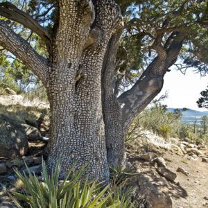
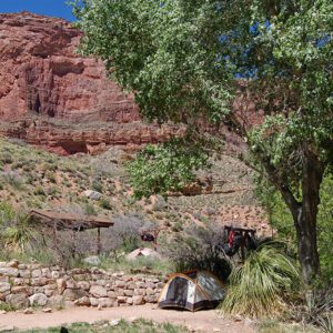
A separate unit six miles upstream contains Montezuma Well, a water-filled sinkhole with ancient irrigation ditches, small pueblos and pit dwellings. Easy, interpretive hiking trails highlight these attractions.
Visiting the monument
Early people in central Arizona found prime real estate in the Verde Valley. Room by room, they built a five-story apartment complex into an alcove on a cliff wall overlooking Beaver Creek, a tributary of the Verde River. Montezuma Castle, as it’s called today, is one of the best-preserved cliff dwellings in North America. The monument protects this archaeological site and its cultural history. Unfortunately, looters stole many of the original artifacts before the site received federal protection in 1906, when Theodore Roosevelt used the newly passed Antiquities Act to designate our first four national monuments.
Trails: Both units of the monument have short, paved trails—a 1/3 mile trail at Montezuma Castle and a ½ mile trail at Montezuma Well.
Getting there
To Montezuma Castle National Monument: head south on I-17 from Flagstaff, take exit 289 and turn left on W. Middle Verde Road. Continue for 0.4 mi, passing underneath the overpass and continuing straight through two roundabouts. Turn left onto Montezuma Castle Road; the monument is about 1.8 miles farther.
To Montezuma Well from Montezuma Castle: return to I-17 and drive north for about 3 miles. Take exit 293 towards McGuireville, continuing straight on E. Beaver Creek Road through the towns of McGuireville and Rimrock. Follow signs for Montezuma Well, and continue northeast for a total of 4.3 miles. Turn right into the entrance and parking area for the Well.
Montezuma Castle itself
Montezuma Castle is, in fact, a misnomer. Early visitors to the site in 1864 wrongly attributed the builders of the dwelling to the Aztecs and named the cliff dwelling after the Aztec emperor. This misconception happened many times in the Southwest, with the Aztec ruins and the town of Aztec in the northwestern corner of New Mexico as other examples.
The Sinagua people moved into the area around A.D. 1125. Their name means “without water” and was given by archaeologists for their cousins to the north. But here in the Verde Valley and along Beaver Creek, the Sinagua farmers enjoyed plenty of water—a rare condition in the arid Southwest.
Incredibly, the Sinagua carried limestone bricks two-thirds of the way up a 150-foot cliff face to build their home. Using clay, sand, and water, they made mud mortar that cemented stones into 12-inch-thick walls that curve perfectly to match the arc of the alcove. They slowly added rooms, building the complex to its 20-room maximum around A.D. 1300. While the park service removed the ladders allowing visitors to enter the Castle in the early 1950s, a diorama of the interior sits along the paved path below the cliffs and allows a glimpse into the early architectural designs of the Sinagua.
Just around the corner you can view the remains of a second pueblo, “Castle A.” The roof and walls of this former 6-story, 40-room building have collapsed into a pile along the base of the cliffs. With Castle A, Montezuma Castle, and several smaller pueblos in the area, archaeologists estimate that around 300 people lived in the neighborhood.
Expanding the monument: addition of Montezuma Well
Nearly 40 years after President Theodore Roosevelt proclaimed Montezuma Castle a national monument, Congress added a separate unit to the monument. Montezuma Well, the second unit, is located 6 miles upstream of the Castle. The “Well” is a limestone sinkhole 368 feet across, which formed when an underground cavern collapsed.
More than one million gallons of water a day flow into the Well, having made a long and slow journey from the higher plateaus in northern Arizona. Precipitation seeps into the ground and flows beneath the surface for up to 13,000 years before emerging through two vents at the bottom of the sinkhole.
The 74-degree water has been an important source of life for a very long time. Both the Sinagua and the Hohokam (who lived in the Valley prior to the Sinagua) diverted water from the Well to their nearby fields through irrigation canals. These ditches are naturally cemented with calcium carbonate that has settled out of the water. Today, neighboring communities such as Rimrock rely on Montezuma Well for irrigation water.
The water chemistry doesn’t allow fish to live in the Well, but other aquatic life thrives here—certain beetles, marsh treaders, and other water bugs skim across the surface. Montezuma Well has five species found nowhere else, including a springsnail, water scorpion, and new species of leech.