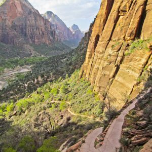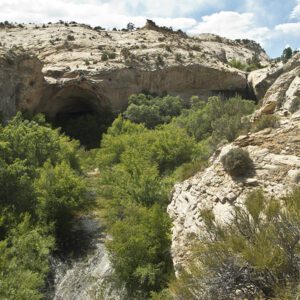
A lesser known park, Capitol Reef National Park is a dramatic landscape of sandstone domes, sculpted canyons, and steep cliffs
Most people see Capitol Reef as a pit stop while traveling between Utah’s more famous parks like Arches and Bryce Canyon, but few actually realize the park’s true potential. For those willing to step out of the car, prepare to have your minds blown.
Visiting the park
Capitol Reef is a long, narrow park that follows a 100-mile-long wrinkle of upturned rock called the Waterpocket Fold. UT 24 cuts east-west through the heart of the park, dividing it into two districts: the southern Waterpocket Fold and the northern Cathedral Valley. Stretch your legs at the trailheads directly off the highway, or venture into the park’s rugged backcountry for a grand adventure.
Waterpocket Fold
The Waterpocket Fold is a tilted ridge cut with creeks and canyons and sculpted into domes, stretching from Thousand Lake Mountain to the Colorado River. Geologically, it is the remnant of 10,000 feet of rock strata deposited about 100 million years ago. Erosion has beveled off this rugged country, but a trio of sandstones—Wingate, Kayenta, and Navajo—remain as a rock wonderland. So, get out there and explore!
Trails off UT 24: Sulphur Creek Trail | Chimney Rock Trail | Grand Wash
Trails off Scenic Drive: Fremont Gorge Overlook Trail | Cohab Canyon to Grand Wash | Old Wagon Trail | Pleasant Creek
Trails off Burr Trail Road: Upper Muley Twist
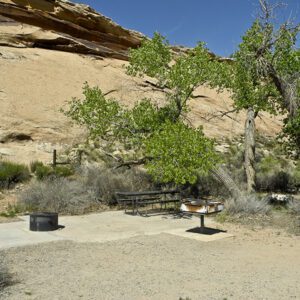
Campgrounds: Cedar Mesa Campground | Fruita Campground
Fruita
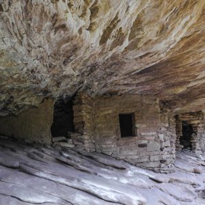
The historic town of Fruita straddles the highway, and its lushous orchards and fields seem a bit out of place among the sea of rock. In the late 1800s, Mormon pioneers spread throughout southeastern Utah, establishing communities in remote places to expand the church’s influence. In the early 1900s, they arrived in the Capitol Reef area and settled near the confluence of two waterways, the Fremont River and Sulphur Creek. At this “junction,” the earliest name for the town, they planted fruit trees that still thrive. Their orchards provided a large part of their livelihood, and when it came time to establish a local post office, they chose the name “Fruita” for their town because a Junction, Utah, already existed.
When the National Park Service acquired the lands that make up Capitol Reef, it removed many of the frontier structures but kept the fruit trees. The park service maintains the cherry, apple, pear, and apricot trees as heirloom crops and artifacts of Mormon tenacity and collaboration. Today, you can taste the fruit of the early settlers’ labor—and pick your own fruit for a modest charge. Check at the visitor center for maps of the orchards and to see what’s in season.
Cathedral Valley
North of UT 24, Cathedral Valley differs in character from the rest of the park. Here, gothic monoliths made of Entrada Sandstone rise from wide valleys, surrounded by multicolored shale hills. Several scenic roads traverse the landscape, and the park service has good road touring information. Check at the visitor center before you leave for recent road conditions. The clay soils in this area get sticky after rainstorms and can become impassable. This section of the park is rarely visited, and help can be days away. Be prepared and carry extra supplies.
General Location Southern Utah
Closest Towns Torrey, Utah
Cost Vehicle Permit: $20 to drive on the park's Scenic Drive beyond the Fruita Campground
Managed By National Park Service
Pets Leashed pets are allowed in the developed areas of the park (paved and dirt roadways, picnic areas, orchards, and campgrounds). Pets are NOT allowed on hiking trails, in public buildings, or in the backcountry.
More Info NPS website
Adventure awaits
Sign up to get monthly hikes in your inbox for a year.

Special membership offer
Join the Grand Canyon Trust today to receive your adventure kit:
- $25 donation: a Grand Canyon map, The Advocate magazine subscription, bookmark, and sticker
- $75 donation: everything above plus four stunning note cards
- $100 donation: all the benefits of the $75 level, plus a Grand Canyon Trust hat
Related Hikes by Destination

Sites: 25
Season: Open year-round
Reservations: For groups sites only

Distance: 8 mi (12.9 km)
Difficulty: Easy
Type: Out and back

State: Utah
Nearest Town: Springdale, Utah

Distance: 2.2 mi (3.5 km)
Difficulty: Moderate
Type: Out and back
