Bryce Canyon National Park occupies a thin sliver of southern Utah, but the surreal landscape makes a big impression
The “canyon” really is a series of natural amphitheaters on the eastern side of the Paunsaugunt Plateau, filled with coral-colored hoodoos, totems, and spires. The formations take shape as softer rock erodes, leaving harder layers behind in a maze of domes, windows, and towers. Today, scientists estimate that the eastern rim of the Paunsaugunt is eroding one foot every 50 years. Come visit this dream landscape before it dissolves!
Visiting the park
Bryce Canyon National Park is located in Utah’s high country, and at 8,000 feet elevation, you should expect a wide range of temperatures when visiting the park. Summer months offer the best hiking, with cool mornings heating up to pleasant afternoons. During peak season (June-September), the Park Service recommends that visitors use the free park shuttle bus instead of driving personal vehicles. With limited parking at the overlooks, spots fill up quickly. You can also avoid traffic and entrance lines by riding into the park. There are three shuttle stops outside the park, and eight stops inside the park.
But don’t let the winter months keep you inside, though. Bryce Canyon becomes a snowy wonderland, perfect for cross-country skiing and snowshoeing. With fewer people on the trails, your company comes in the form of hoodoos instead of tourists.
Regardless of the time of year you visit, expect clear skies and starry nights. Bryce Canyon is famous as a “night sky sanctuary,” far away from any source of light pollution. Bring your star chart, or attend a ranger-led astronomy program.
Trails: Fairyland Loop | Queen’s Garden & Navajo Loop
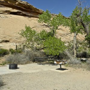
Campgrounds: North Campground | Sunset Campground
Geology
Bryce Canyon’s multicolored rock is nature’s version of chinaware – lavish, dainty, and easy to break. Over time, the cliffs have eroded into a beautifully sculpted amphitheater filled with statuesque hoodoos, window openings, and long fins.
The geologic story that explains these finely shaped features began about 55 million years ago, when a freshwater lake covered south-central Utah. Lake and stream sediments accumulated into what’s now known as the Claron Formation. The plateau was uplifted more recently, exposing these alternating layers of limestone, siltstone, and mudstone to erosion. Because some rocks are soft and some are hard, they erode at different rates, creating a landscape that continues to change with each winter freeze, spring thaw, and summer rainstorm.
Alternating cliffs and plateaus step up from the Grand Canyon to the top of the Paunsaugunt Plateau. Bryce Canyon sits on top of the Paunsaugunt Plateau, the final step – called the Pink Cliffs — in what’s known as the Grand Staircase. While Bryce Canyon is a small sliver of the staircase, it’s part of a bigger geologic record that spans 200 million years.
General Location South-central Utah
Closest Towns Panguitch and Tropic, Utah
Cost Vehicle Permit: $35 (check the website below for current information)
Managed By National Park Service
Pets Leashed pets are permitted on all paved surfaces in the park: campgrounds, parking lots, paved roads, paved viewpoint areas, and paved trails. Pets are NOT allowed on unpaved trails or viewpoints, in public buildings or on public transportation vehicles.
More Info NPS website
Adventure awaits
Sign up to get monthly hikes in your inbox for a year.

Special membership offer
Join the Grand Canyon Trust today to receive your adventure kit:
- $25 donation: a Grand Canyon map, The Advocate magazine subscription, bookmark, and sticker
- $75 donation: everything above plus four stunning note cards
- $100 donation: all the benefits of the $75 level, plus a Grand Canyon Trust hat
Related Hikes by Destination

Sites: 25
Season: Open year-round
Reservations: For groups sites only

Distance: 8 mi (12.9 km)
Difficulty: Easy
Type: Out and back

State: Utah
Nearest Town: Springdale, Utah

Distance: 2.2 mi (3.5 km)
Difficulty: Moderate
Type: Out and back

