Hike the Ken Patrick Trail on the north rim of Grand Canyon National Park
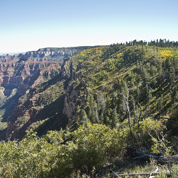
Follow the rim above Nankoweap Basin on this section of the Ken Patrick Trail, between Cape Royal and Point Imperial.
Note: This trail description begins on the road to Cape Royal and goes three miles one way to Point Imperial; you may wish to begin at Point Imperial and go in the reverse direction. There is no water available at the trailhead or Point Imperial.
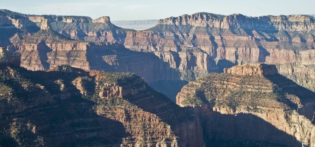
After descending the old sandstone steps, you turn left onto the trail and begin a gentle climb uphill. At the top, the view opens out to the east. The Coconino Sandstone spire thrusting up in the middle of Nankoweap Basin is Mount Hayden, named after Charles T. Hayden, Arizona pioneer and father of U.S. Senator Carl Hayden. It is a popular ascent for technical rock climbers. Point Imperial, the highest point in Grand Canyon National Park accessed by a road, is on the left; the hazy blue hump rising far on the horizon between Point Imperial and Mount Hayden is Navajo Mountain, 80 miles away.
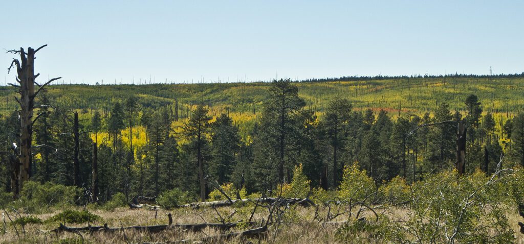
Views to the west also open up. Much of the trail passes through the footprint of the Outlet Fire that burned the area in 2000. In the fall, vibrant stands of yellow-leafed aspen and rust-colored Gambel oak are sprinkled across the burned area.
Through the burn scar
As the trail continues, you pass through a small pocket of unburned forest tucked in a small basin. You quickly re-enter the burn scar and climb up a charred bench. The trail turns to the right and goes to a good viewpoint — you can see the gash of the Little Colorado River gorge, and far to the south the San Francisco Peaks near Flagstaff, as well as Kendrick and Bill Williams Mountains to the right of the Peaks.
Road noise becomes more evident after leaving the viewpoint. The trail drops into a densely vegetated gully below the Point Imperial road and climbs steeply back out again. Continue to follow the rim on a gentle climb towards Point Imperial through nicely spaced old-growth ponderosa pines. The trail ends at the west end of the parking lot for the Point Imperial overlook.
If you walk across the parking lot you can get a view, although not a solitary one like you enjoyed on the trail, into the next amphitheater of Nankoweap Basin and a good view of Saddle Mountain. The Nankoweap trail to the Colorado River begins its descent into the basin just to the right of the saddle.
Unless you have arranged a shuttle, return the way you came.
Directions to the trailhead
Drive 3 miles north of the Grand Canyon Lodge to the road going to Point Imperial and Cape Royal. Turn right and drive 6.5 miles (about a mile past the junction with the road to Point Imperial) towards Cape Royal. Look for a white painted crosswalk on a sharp hairpin turn to the right. The Ken Patrick trail crosses the highway here. Park on the right side of the road, walk across it, go down the stone steps, and turn left on the trail that parallels the rim. (The entire Ken Patrick trail is 7 miles and begins at the North Kaibab trailhead). Read more about how to obtain backcountry permits for Grand Canyon hikes