Walnut Canyon National Monument is a 400-foot deep fissure where the Sinagua built homes in A.D. 1150
Walnut Canyon National Monument is a great place to slow down, enjoy some peace and serenity, and learn about the amazing adaptability of the Indigenous peoples who lived here hundreds of years ago. Take time for a picnic and enjoy the call of the jays, the melodious call of the canyon wren, and the antics of the ever-present ravens.
Visiting the monument
Visiting Walnut Canyon National Monument feels like stepping back in time to a simpler, more friendly era. It is a small monument (3,600 acres) with relatively few visitors (125,000) compared to the big famous parks like the Grand Canyon (5.5 million visitors). The unpretentious visitor center hangs over the wall of the canyon and large windows provide a great view. Behind the visitor center, where the Island Trail begins, a small flagstone porch and patio are examples of some of the original rock work and beams installed in the 1930s by the Civilian Conservation Corps.
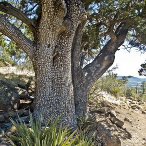
Walnut Canyon is a biological hotspot because of the seasonal stream in the bottom of it, the sunny and shady walls, the flat rims, and the different soil and rock types. At least 387 species of plants have been identified in the monument.
Getting there
From downtown Flagstaff: Drive 3.5 miles east on Highway 89 to the junction with historic Route 66, turn right and proceed past the Flagstaff Mall for 4.5 miles, at which point the road meets Interstate 40. Continue across the freeway and go straight past the Walnut Canyon National Monument sign and follow the entrance road south for 3.3 miles.
From Interstate 40: Take Exit 204 and look for the Walnut Canyon NM sign. Follow the entrance road south for 3.3 miles.
The Sinagua
Modern-day archaeologists named the early residents of Walnut Canyon the Sinagua, which means “without water” in Spanish. Around A.D. 1150 the Sinagua began building homes tucked into rock overhangs along ledges in the canyon walls. Beans, corn, and squash raised on the land surrounding the canyon, along with wild plants, deer, rabbits and other wildlife provided sustenance.
The Island Trail, which drops down 240 steps from the visitor center, passes by 25 Sinaguan structures as it follows one of the rock ledges around a large rock promontory in the canyon known as the Island. There are also Archaic sites in the monument left by people living in the area 2,500 years ago.
Geology
Looking at the canyon walls, note the difference between the upper layers of rock, which are horizontal and the lower layers that are “crossbedded” (striations in the rock that are pitched at different angles). The upper layers are Kaibab Limestone, which also caps the South Rim of the Grand Canyon, and the lower layers are Coconino Sandstone. The Kaibab Limestone was laid down about 265 million years ago at the bottom of an inland sea, while the Coconino is composed of wind-blown petrified sand dunes from about 275 million years ago.
Rim Trail
This trail begins a dozen paces east of the entrance to the visitor center; look for a paved trail and sign. Within the first hundred yards you reach an overlook with a railing that provides a view of the canyon floor and the rocky butte within the canyon known as the Island.
A couple of hundred feet beyond the overlook you come to a junction with a paved trail coming in from the left that goes to a restored pithouse and pueblo. The trail continues for several hundred feet where it ends at another overlook with views into the canyon and a sweeping view of the San Francisco Peaks to the northwest.
Return the way you came until you reach the junction mentioned earlier, go left up the gentle grade where the vegetation becomes a bit more dense as the microclimate of the more arid rim is left behind. The trail passes some picnic tables and after making an abrupt left turn it arrives at a pithouse and pueblo. After looking at these, return to the visitor center, which is easily seen through the trees.