Add the Grandstaff Trail to your hiking list when you visit Moab, Utah
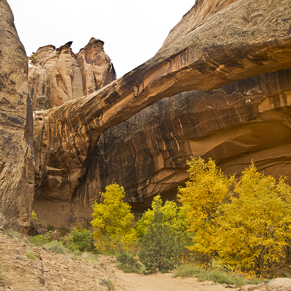
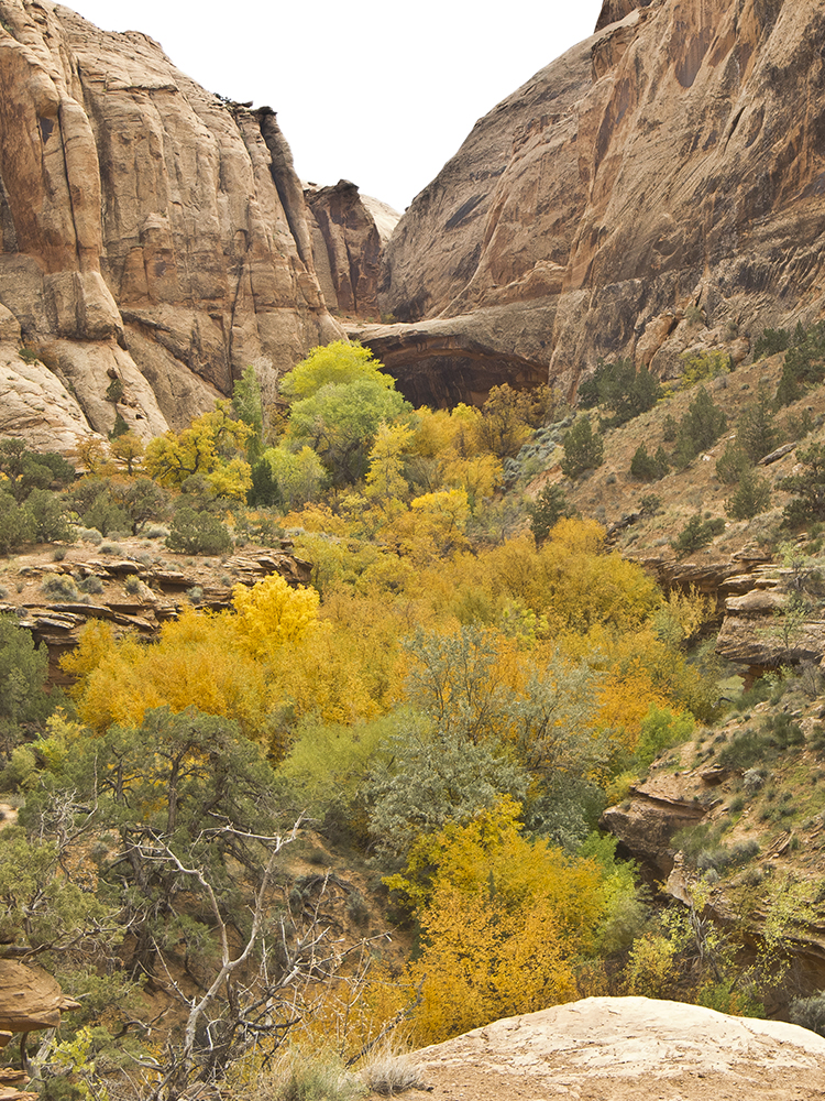
Hike up a deep sandstone canyon along a perennial creek with lush vegetation, and end at a large, unusual bridge.
Note: Beware of poison ivy along this trail; it is quite plentiful under Morning Glory Bridge.
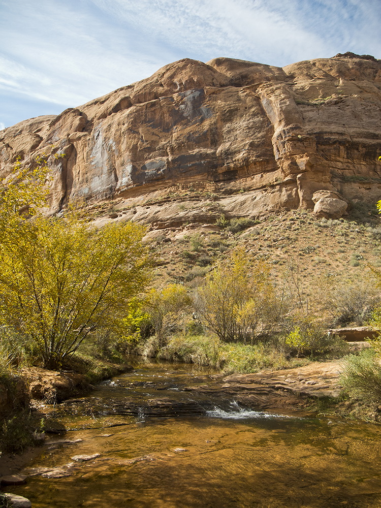
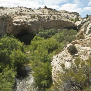
Leaving the Grandstaff Trail parking area behind, the trail drops down the east side of the creek, which runs year-round. The sound of running water bouncing off the cliff walls makes this hike pleasant and unusual in the arid Southwest. After a few hundred yards, the trail breaks out of the riparian vegetation into an open area that is heavily infested with Russian thistle, a legacy of the cattle that grazed here for many decades.
Conservation controversy
At about 0.4 mile, you reach a trail register and the boundary of a wilderness study area, the establishment of which created a great deal of controversy a few decades ago during the so-called Sagebrush Rebellion. Many locals believed that the federal government overstepped its authority when it designated the wilderness study area, and they bulldozed a road into the canyon so it would no longer qualify as wilderness. However, the wilderness study area was established after a negotiated court settlement between the local protestors and the government.
You reach the first creek crossing about a mile from the trailhead. Except during heavy runoff, you can cross easily by hopping from rock to rock. The trail crosses the stream a few more times in the next several hundred feet. At 1.2 miles, a canyon comes in from the right where you cross the creek again, climb a short steep hill to a sandy bench, and continue up the main canyon.
To Morning Glory Bridge
At 1.7 miles, another canyon comes in from the right; the trail goes up this canyon to reach Morning Glory Bridge. After crossing the creek and starting up the canyon, you climb to the top of another sandy bench, and at 2 miles you get your first view of the bridge. Continue along the bench and then drop back down to stream level, where the trail abruptly ends at a wall and a large pouroff, with Morning Glory Bridge soaring above.
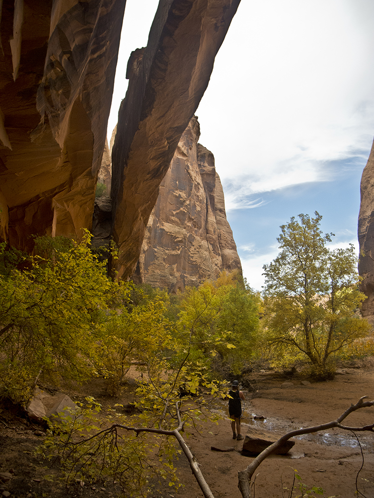
Unlike most natural bridges this one runs parallel to one of the canyon walls (a mere 15 feet away from it) rather than spanning the canyon. Stretching 243 feet from one end to the other, this bridge is eroded out of one of the rock fins that are abundant in the area. Erosion of these fins also forms most of the arches in nearby Arches National Park, but unlike those, this is considered a bridge because it was created by a stream flowing beneath it. There is a waterfall at the southern end of the bridge and a large sandy area where you can relax in the shade and take in the awesome and unusual scene, but keep an eye out for plentiful poison ivy.
After savoring this special spot, enjoy strolling back the way you came.
Directions to the Grandstaff Trail
From downtown Moab, Utah, drive north on US 191 for about 2.5 miles to the junction with UT 128 at the Colorado River. Turn right and drive 3.2 miles to the trailhead on the right.
Need a place to camp? Grandstaff Campground is right across the street
General Location Moab, Utah
Distance 4.4 miles (7 km)
Difficulty Moderate
Trailhead Elevation 3,950 ft (1,204 m)
Highest/Lowest Elevation 4,250/3,950 ft (1,295/1,204 m)
Managed By Bureau of Land Management
Fees No fee – Check the website below for current information.
Pets Allowed
More Info BLM website
Adventure awaits
Sign up to get three hikes in your inbox every month for a year.

Special membership offer
Join the Grand Canyon Trust today to receive your adventure kit:
- $25 donation: a Grand Canyon map, The Advocate magazine subscription, bookmark, and sticker
- $75 donation: everything above plus four stunning note cards
- $100 donation: all the benefits of the $75 level, plus a Grand Canyon Trust hat
Related Hikes by Destination
Sites: 25
Season: Open year-round
Reservations: For groups sites only
Distance: 8 mi (12.9 km)
Difficulty: Easy
Type: Out and back
State: Utah
Nearest Town: Springdale, Utah
Distance: 2.2 mi (3.5 km)
Difficulty: Moderate
Type: Out and back
