This route strings together all the hiking trails at Dead Horse Point State Park, looping around the peninsula in a counterclockwise direction
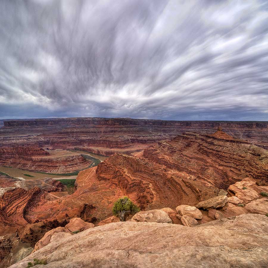
At Dead Horse Point State Park, tributaries of the Colorado River have shaped the high plateau, cutting a series of curved amphitheaters ending in points around a peninsula.
The West and East Rim trails contour around the peninsula, while spur trails branch out to the points. If the hike and the views become repetitious, consider skipping one or several spurs. The hike is 8.8 miles total if you take all the spurs, 4 miles if you take none.
West Rim Trail
The West Rim Trail accesses Big Horn Overlook, Rim Overlook, Shafer Canyon Overlook, and Meander Overlook, and ends at Dead Horse Point. To find the trail, walk around to the back (south side) of the visitor center and look for a sign with arrows to the Nature Trail, East Rim Trail, and West Rim Trail. Turn right, following the West Rim Trail past the visitor center and bathrooms, across the park road, and along the north side of the campground.
Between spurs, the West Rim Trail is an easy, undulating walk marked by cairns. In the distance, you can see the La Sals to the east, the Abajos to the south, and the Henry Mountains to the west.
Big Horn Overlook
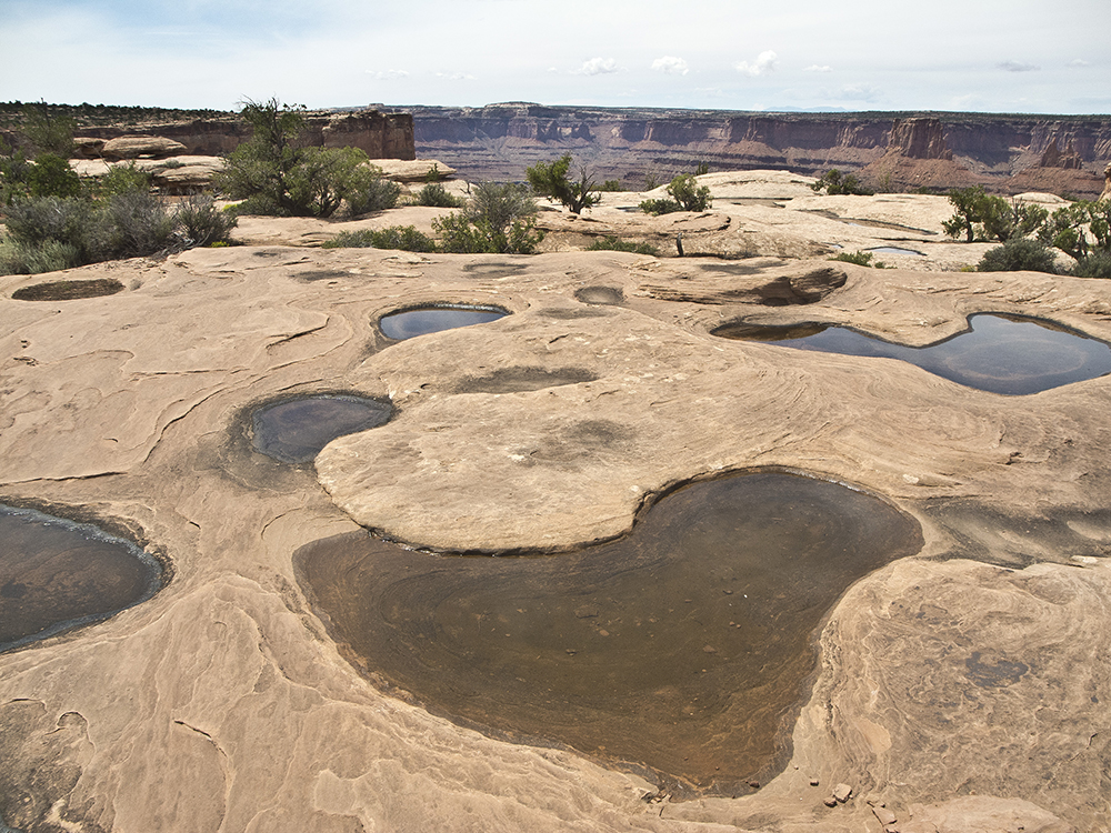
In a half mile, you reach the Big Horn Overlook spur trail. Veer right, cutting across the piñon and juniper studded plateau before swinging north to the canyon rim. The East Fork of Shafer Canyon drops off to your left, and you contour around an amphitheater as you proceed to Big Horn Overlook. Where slickrock replaces the sandy trail, follow cairns to the end of a potholed ridge.
The vast views from the tip are breathtaking, but if it’s rained recently, the dimpled rock you’re standing on steals your attention. These shallow potholes carved in the rock collect rainwater, forming pools where micro ecosystems of tiny organisms like mites, tadpoles, and mosquitoes thrive. As the pools dry up, some organisms fly away while others enter a dormant stage and wait for the next rain.
After admiring the potholes and view, retrace your steps back to the West Rim Trail and turn right.
Rim Overlook
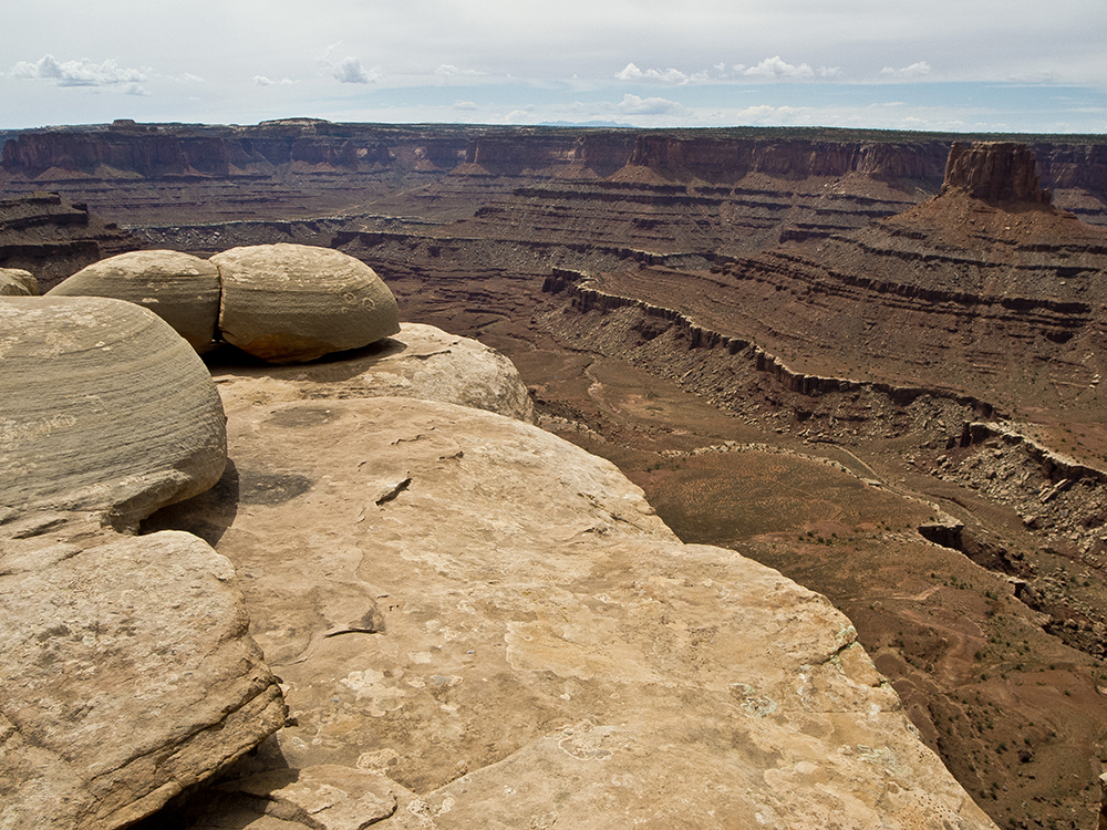
In 0.3 mile from the last overlook, you reach the spur to Rim Overlook. This half-mile round trip jaunt gives you more views into Shafer Canyon.
Shafer Canyon Overlook
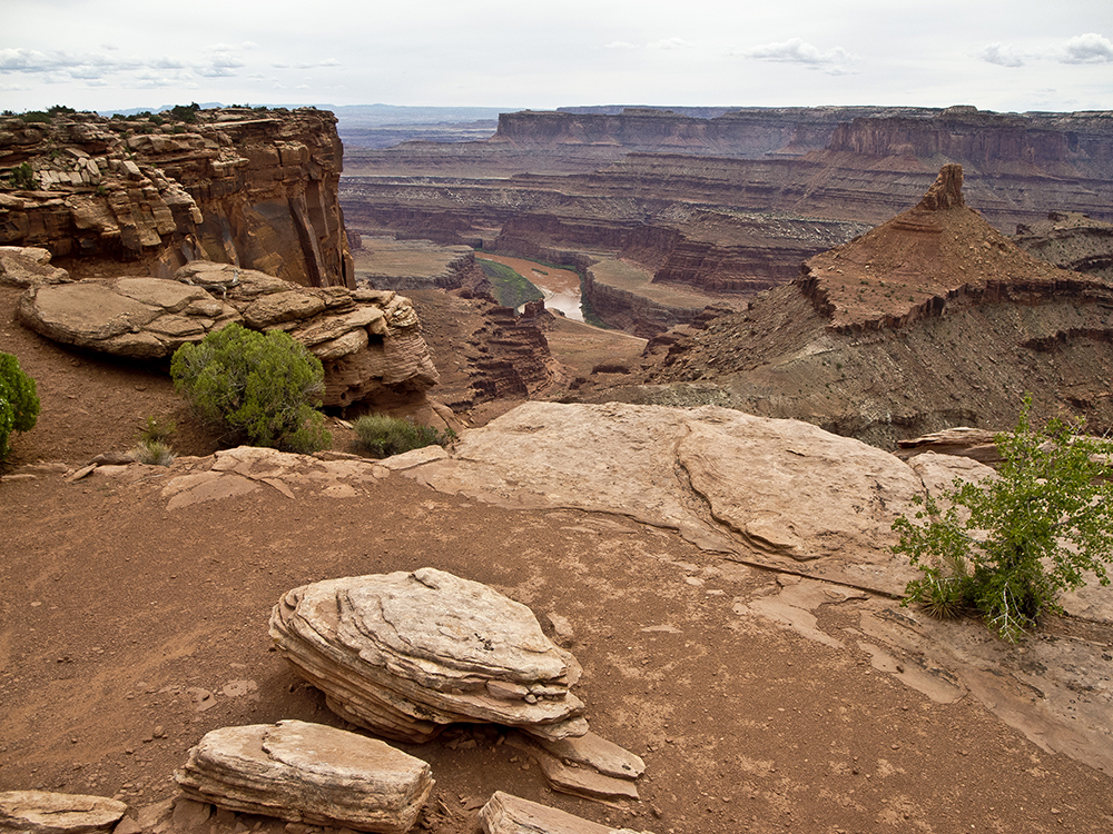
Back on the West Rim Trail, you turn south and soon arrive at the spur trail to Shafer Canyon Overlook. Views from this point are similar to the last, but here you get your first glimpse of the Colorado River 2,000 feet below.
Meander Overlook
Meander Overlook is a few steps off the trail and a tenth of a mile past Shafer Canyon Overlook. From here, you can see a big bend in the Colorado River.
Dead Horse Point
To reach Dead Horse Point, continue on the West Rim Trail for another mile. Where the peninsula pinches into a “neck,” you end up hiking next to the road. Contour close to the rim’s edge for the rest of the way, until you hit a paved path that takes you to Dead Horse Point. There you find bathrooms, picnic tables, shade structures, and most important, a magnificent panoramic view.
The Colorado River has cut down 2,000 feet through rock layers, revealing 300 million years of Earth’s history. You can trace the layers starting with Entrada Sandstone at the top of the cliffs down to the Honaker Trail Formation at river level.
East Rim Trail
Continuing around the tip of the peninsula, you unknowingly pick up the East Rim Trail, partly paved and partly slickrock. Look to the east down by the river to see the milky blue ponds of a potash mine as you curve back around to the “neck.”
The East Rim Trail turns to gravel and hugs the edge of the rim, offering good views into Shafer Basin with the La Sal Mountains rising to the east. Basin Overlook spur trail is a short walk to a viewpoint of Pyramid Butte and Chimney Rock.
Continue following the trail back to the visitor center.
Colorado River Overlook
If you want to add another mile to the hike, continue on the paved Nature Trail. This quickly turns back to dirt as you pick up the Colorado River Overlook Trail and walk north past the parking lot. The foot trail parallels the Intrepid Loop mountain bike route off to your left. Pass a few potholes, and end at another overlook of the Colorado River. Retrace your steps back to the visitor center.
Directions to Dead Horse Point State Park
From the visitor center in Moab, Utah, drive 11 miles north on Hwy 191. Turn left onto UT 313, and follow signs to Dead Horse Point State Park. Make a left turn to stay on UT 313 at the signed junction (straight goes to Canyonlands National Park). You reach the park entrance station at 30 miles. Continue down the road and park in the lot at the visitor center. The loop described here starts behind the visitor center.
General Location Moab, Utah
Distance 8.8 miles (14.2 km)
Difficulty Moderate
Trailhead Elevation 5,875 ft (1,790 m)
Highest/Lowest Elevation 5,950/5,775 ft (1,814/1,760 m)
Managed By Dead Horse Point State Park
Fees Park entrance fee required – Check the website below for current information
Pets Allowed on a leash
More Info State Park website
Adventure awaits
Sign up to get three hikes in your inbox every month for a year.

Special membership offer
Join the Grand Canyon Trust today to receive your adventure kit:
- $25 donation: a Grand Canyon map, The Advocate magazine subscription, bookmark, and sticker
- $75 donation: everything above plus four stunning note cards
- $100 donation: all the benefits of the $75 level, plus a Grand Canyon Trust hat
Related Hikes by Destination
Sites: 25
Season: Open year-round
Reservations: For groups sites only
Distance: 8 mi (12.9 km)
Difficulty: Easy
Type: Out and back
State: Utah
Nearest Town: Springdale, Utah
Distance: 2.2 mi (3.5 km)
Difficulty: Moderate
Type: Out and back
