Don’t miss hiking the Weatherford Trail, a Flagstaff favorite that climbs up the San Francisco Peaks!
Be ready for thin air while climbing up the Weatherford Trail.
Note: For a shorter day hike (13.2 miles round trip), plan on turning around at Fremont Saddle. Other options for extended trips (see below) include dropping a shuttle car at the Humphreys Peak Trailhead or the Inner Basin Trailhead. Make sure you determine your route ahead of time, calculate the total hiking mileage, and make appropriate transportation arrangements.
The Weatherford Trail starts on the north side of the Schultz Tank Trailhead parking area. It follows the remnants of an old toll road that was intended to reach the top of the San Francisco Peaks. But, when the Great Depression hit, the road was abandoned at Humphreys Saddle and eventually closed to motor vehicles in 1984.
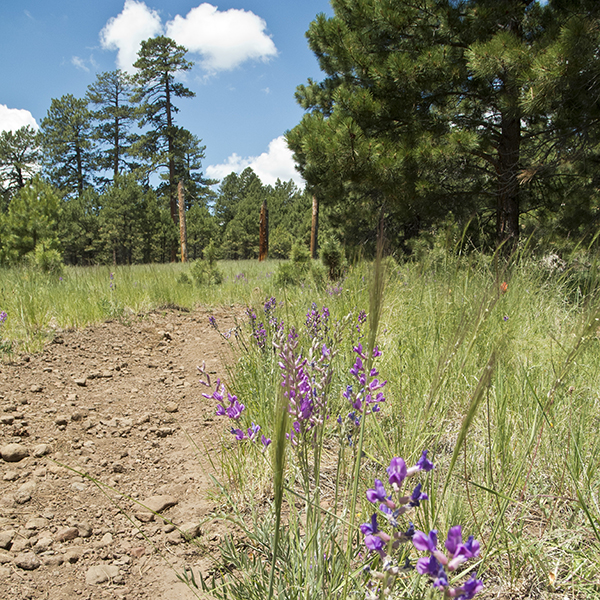
From the brown trail sign, the trail heads north along the faint two-track road and climbs a gradual yet steady grade. A few hundred feet up the trail, the Moto and Arizona trails come in from the left. Stay straight on the Weatherford Trail, and pass over a gas pipeline area that runs perpendicular to it. Ponderosa pines give way to groves of aspen trees, with lupines and penstemons adding pops of color to the forest floor. Gaps in the trees afford occasional glimpses of the San Francisco Peaks, but it’s not until you reach the junction with old Freidlein Prairie Road/Kachina Trail that views open up to the north (around 1.7 miles).
Up Weatherford Canyon to Fremont Saddle
Continuing north, you cross a grassy meadow encircled with aspen trees. Schultz Peak off to your right burned in the 2010 Schultz Fire that started from a campfire spark and grew into one of the largest, hottest fires in Coconino National Forest’s history.
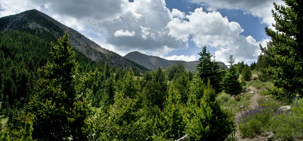
As the trail works back into Weatherford Canyon, you pass a Kachina Peaks Wilderness sign, soon followed by a trail register box. Around 3.3 miles, the gradual incline turns into sweeping switchbacks as you continue climbing up towards Fremont Saddle. The forest opens up in a half mile, with southern views including the NAU Skydome, the town of Flagstaff, and several cinder hills.
Having climbed nearly 3,000 feet in elevation, you reach Fremont Saddle around 6.8 miles. Fremont Peak is to the west, and Doyle Peak is to the east. Enjoy views into the Inner Basin, the eroded crater left behind from the San Francisco volcano. This is a nice place to turn around for a shorter day hike.
On towards Doyle Saddle
The trail skirts the Inner Basin, contouring around the north side of Fremont Peak. Avalanche tracks streak down the talus slopes, and camping is prohibited along this stretch of trail between Fremont and Doyle saddles. At points, you can see the Inner Basin Trail below, which joins the Weatherford Trail at 7.8 miles. A mile of climbing up tight switchbacks places you at Doyle Saddle, oddly named since it connects Fremont and Agassiz peaks. Trees obscure most of the panoramic views.
Final push to the top
From Doyle Saddle, the trail turns north and continues climbing another 700 feet. You make a tight switchback around 9.2 miles, and from there on, you’re hiking above treeline. While the exposed scree slopes require most of your attention, make sure to pause and look to the east for sweeping views of the Inner Basin and Painted Desert beyond. You may see piles of snow scattered in the valley below, even in the summer months.
Continue ascending the switchbacks on the east flank of Agassiz Peak. At 10 miles, you reach the high point of the hike at nearly 12,000 feet elevation. The trail hooks around to the west of a ridge, and reaches Humphreys Saddle at 10.4 miles. The Weatherford Trail ends here, as it connects with the Humphreys Trail.
Extended hike options
Humphreys Summit is a mile farther up the trail, and the Snowbowl Parking lot (Humphreys Peak Trailhead) is 3.8 miles down the other side of the mountain. For details, see the Humphreys Peak Trail description.
Note: Before hiking up the Weatherford Trail, be sure to check the weather forecast. For most people this is a summer hike, and summer monsoons bring intense thunderstorms and lightning to the mountains. It’s best to start early in the morning and keep a close watch for cloud buildup, especially above treeline.
Directions to the trailhead
From the intersection of Rte 66 and N. Humphreys Street in downtown Flagstaff, head north on N. Humphreys Street for about 0.6 mile. Turn left onto Hwy 180/Fort Valley Road, and continue for another 2.6 miles. Pass the Museum of Northern Arizona, and at the next stoplight, turn right onto Schultz Pass Road. Keep left at the fork to stay on this road (straight turns into Elden Lookout Road), and follow it for 5.5 miles until you reach the Schultz Tank Trailhead and parking area on the right.
General Location Flagstaff, Arizona
Distance 20.8 miles (16.7 km) or less
Difficulty Strenuous
Trailhead Elevation 8,000 feet (2,438 m)
Highest/Lowest Elevation 11,985/8,000 feet (3,653/2,438 m)
Managed By Coconino National Forest
Fees No fee – Check the website below for current information.
Pets Allowed, check for restrictions
More Info USFS website

Adventure awaits
Sign up to get three hikes in your inbox every month for a year.

Special membership offer
Join the Grand Canyon Trust today to receive your adventure kit:
- $25 donation: a Grand Canyon map, The Advocate magazine subscription, bookmark, and sticker
- $75 donation: everything above plus four stunning note cards
- $100 donation: all the benefits of the $75 level, plus a Grand Canyon Trust hat
Related Hikes by Destination
Distance: 5.2 miles (8.4 km)
Difficulty: Strenuous
Type: Out and back
Sites: 15
Season: Open year-round
Reservations: Backcountry permit required
State: Arizona
Nearest Towns: Flagstaff, Williams, Tusayan, and Cameron, Arizona
Distance: Up to 13 miles
Difficulty: Easy
Type: Point-to-point
