Turn back time as you hike along Sulphur Creek to see the oldest rock layers in Capitol Reef National Park
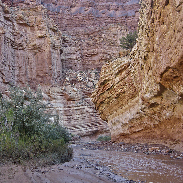
Sulphur Creek takes you through the narrow walls of a cinnamon-colored canyon.
Cross over to the south side of the highway, and start hiking down the path directly across from the parking area. A sign marks the beginning of the trail and points straight ahead towards Sulphur Creek. Cross the wash, following the trail into a labyrinth of drainages. Just stay left whenever the wash appears to split at a junction, following the broad wash deeper into the Moenkopi Formation.
The Moenkopi’s cinnamon-colored rocks surround you, having been swept into layers by currents in ancient river, delta, and tidal basin systems. As you follow the trail, you can see Chimney Rock behind you set against stacked slabs of Moenkopi. While you can always hike in the bottom of the wash, the trail cuts across sandy benches.
You see several pour offs in the wash as you near Sulphur Creek — at their bases, there may be muddy puddles if recent rains have passed through the area. After a mile of hiking, cairns mark a higher route on the right bank. Following this route cuts off some distance but makes for a rocky and steep descent back down. Staying in the wash also takes you to a terraced pour off, which is slightly easier to navigate. Expect some type of downclimb either way, though both are quite passable.
By now, you can hear the murmur of running water — Sulphur Creek is just a quarter mile farther. Cairns lead you to the worn route on the left bank, and you arrive at another trail sign that points left towards the visitors center, 4.5 miles east along Sulphur Creek.
Glimpse into the past
For the rest of the hike, simply follow the creek. As you continue downcanyon, you can follow various overland paths if you don’t want to slosh through the water.
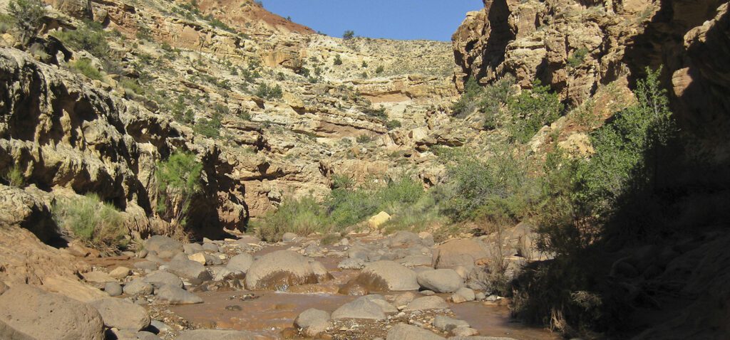
The walls grow in stature as you go, and new layers of rock are exposed — Kaibab Limestone and White Rim Sandstone, blush-colored layers beneath the Moenkopi. At over 250 and 280 million years old respectively, the Kaibab and White Rim are the oldest rocks in Capitol Reef’s amazing sedimentary display.
Through the goosenecks — the sinuous stretch of creek with tight curves — the canyon walls rise to 800 feet tall. Look for guardrails above you, which are part of the Goosenecks Overlook Trail just off UT 24.
Dark streaks of desert varnish stain the rosy walls, and you pass several swiss cheese boulders close to 2.5 miles. A quarter mile farther and the banks become littered with the basalt boulders you see throughout the park, washed down from nearby Boulder and Thousand Lake Mountains. The narrowing canyon walls push you to walk in the creek along the slickrock floor, and the churning water grows louder as you approach the small waterfall. You have to maneuver around some big rocks; watch your step—they can be slippery.
Around 3.2 miles, the creek runs over an undercut shelf, and the waterfall drops 10 feet into a pool below. Daring hikers can skirt the falls on the right side of the slickrock bowl and continue downstream past another waterfall to the visitor center. But for a more relaxed hike back to the trailhead, return the way you came.
Directions to the trailhead
From the park visitor center: Drive 3 miles west on UT 24 and turn right into the Chimney Rock Trailhead parking area. The trail (an unmaintained route) starts on the opposite (south) side of the road.