Follow an old wagon trail that the early Mormons used at the turn of the 20th century
This quiet trail in Capitol Reef National Park preserves Mormon history and offers great views of the Henry Mountains and Waterpocket Fold.
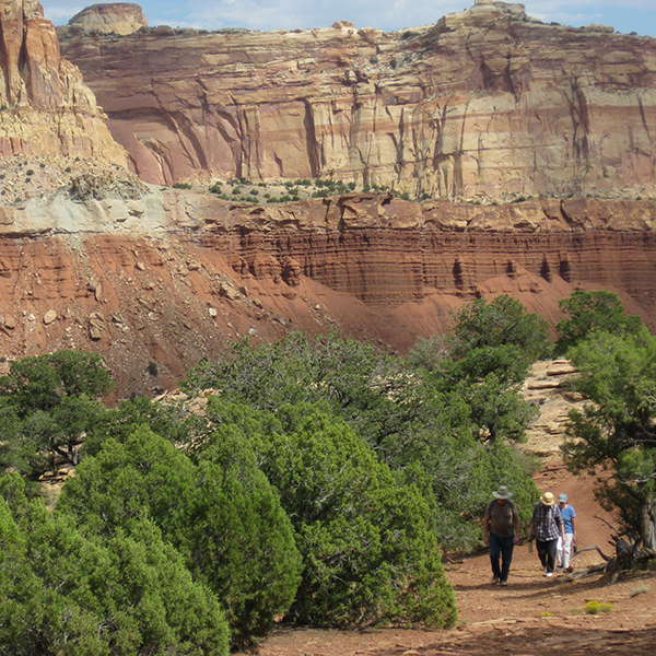
A footpath leaves from the pull off and heads down about 50 feet to the bottom of a wash. A trail sign marks the official start of the hike, and the trail continues due west and steadily gains elevation from there.
Up Miners Mountain
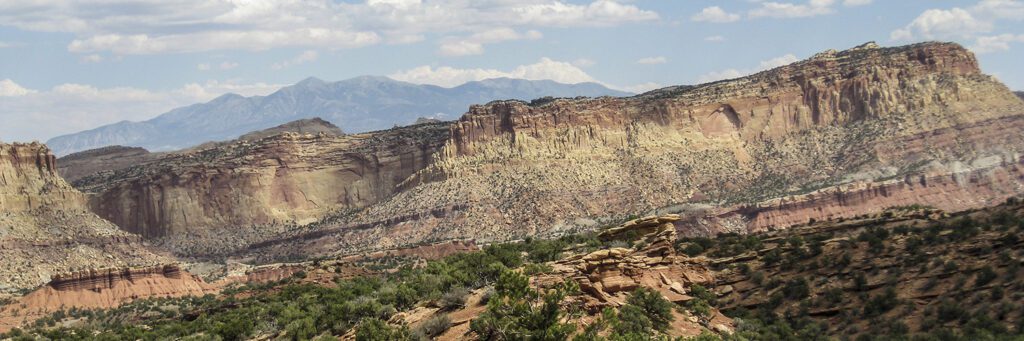
For the first 1.5 miles, your back will be turned to the cliffs on the west side of the Waterpocket Fold as the trail climbs up Miners Mountain. Named for its mineral deposits of copper and uranium, Miners Mountain provides excellent views into the heart of Capitol Reef National Park.
Beneath the broken pieces of chocolate-colored sandstone and mudstone are preserved ancient tidal and shoreline deposits from a former marine environment. This is the Moenkopi Formation, which formed about 240 million years ago during the early Triassic Period. Slabs of rocks stacked in outcroppings show evidence of ancient layers of sand.
As you gain distance from the road, look behind you to see the Henry Mountains rising in stature east of the Waterpocket Fold. In about a mile, the trail drops down slightly, giving your legs a brief relief before you arrive at a wooden post marked “loop” with an arrow pointing left. Following this lollipop-shaped route in a clockwise direction, turn left at the juncture to continue hiking up the hillside.
Old Wagon Route to Overlook
As the scenery and the climb become a bit monotonous, resist the urge to stop. You’ll soon be rewarded for your effort. Around 1.8 miles, the trail bends around to the north, where cliffs, domes, and mountains in the greater Capitol Reef area command your attention. The trail soon levels out, contouring around until you get to another wooden post at 2 miles that directs you to the right for the final part of the loop.
Marked by cairns, the trail follows an old wagon route that is hard to discern in some places. Settlers built the Grover cut-off route, a shortcut that connected their main road west of Capitol Gorge to the towns of Teasdale and Grover, at the turn of the 20th century. Look closely and you might see evidence of wagon ruts and blasting on the rugged trail.
A quarter-mile more of hiking brings you to a scenic viewpoint just off the main trail. Hike to the top of the Moenkopi slabs for panoramic views of the park. The sharp Navajo Sandstone point is Ferns Nipple, a landmark widely seen from many places in the park, while the Golden Throne stands among the three promontories in front of you.
When you climb down and return to the trail post, follow the arrow pointing towards the trailhead. Enjoy your downhill walk and the much-improved scenery on the return trip. The cairns are easy to miss on the last section of the loop, as they blend into the rock-littered slope.
By 3 miles, you have rejoined the portion of trail you already hiked. Finish the walk back to your vehicle.
Directions to the trailhead
From the park visitor center: Continue down the Scenic Drive, passing orchards, the historic Gifford House, and the Fruita Campground in the next 1.5 miles. Stop at the self-pay station to continue on the road towards the trailhead. Drive another 5 miles before arriving at a paved pullout on the right side of the road. With room for about three vehicles, park in the area marked “Old Wagon Trail Hikers Parking.”