This is a popup dialog that overlays the main content of the page. The popup includes a search form to help you find the information you are seeking. Pressing the close button or using the escape key will close the popup.
The hike up Hunter Canyon is an easy walk along the canyon floor
Hunter Canyon may not be a destination hike, but it’s a nice walk if you’re staying at the small campground located in the mouth of the canyon.
From the trailhead, walk southeast upcanyon past several campsites. Wooden posts mark the trail along the wash bottom until you reach a trail register box.
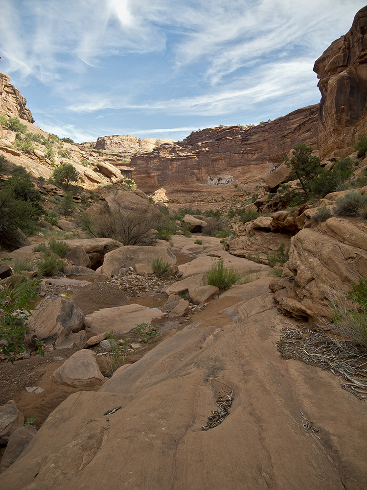
From here, walk as far upcanyon as you wish. Hunter Canyon has narrow sandstone walls that are stained and sculpted. But you may not have too much time to watch the scenery because the brush, boulders, and pools of water that cover the canyon floor make for difficult hiking. Cairns may mark routes of easier passage, but expect to bushwhack your way through thick ranks of Gambel oak and tamarisk trees.
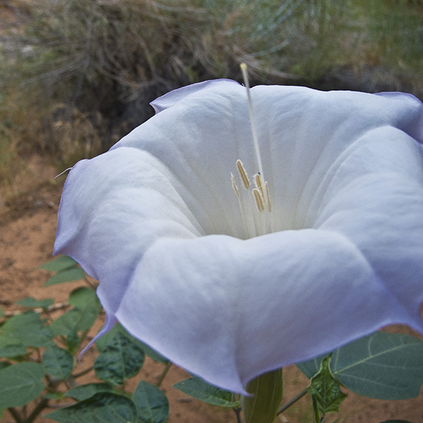
Blossoms of sacred datura and evening primrose help soften the poky vegetation, while juniper trees dot the walls, and a few big cottonwood trees grow in the wash bottom.
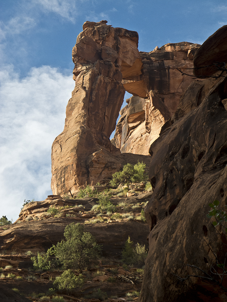
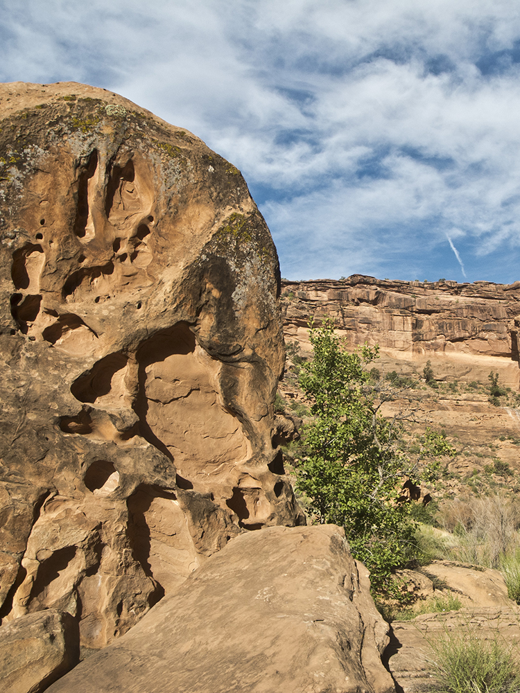
In about a half mile, watch for an arch high on the right canyon wall. Beyond this, dense plantlife pushes you towards the middle of the canyon. Boulders pile up and impart a messy appearance. You pass a cavern high on the left canyon wall around 1.5 miles. Most people turn around near here, but you can continue probing upcanyon until the going becomes so tough you are forced to turn back the way you came.
Directions
From the visitor center in Moab, Utah, drive south on Main Street for about 5 blocks. At the stoplight near McDonald’s, turn right onto Kane Creek Blvd. Veer left at the intersection with 500 W, and continue following the road as it bends left at the Colorado River. The paved road turns to gravel where it climbs the cliff walls at Kane Creek Canyon. Drive cautiously, as the road narrows and has blind curves. You drive to the bottom of Kane Creek via switchbacks, and arrive at the mouth of Hunter Canyon at 8 miles. Park in the small dirt lot on the left side of the road.
General Location8 miles southwest of Moab, Utah
Distance3.4 miles (5.5 km)
DifficultyEasy
Highest/Lowest Elevation4,250/4,100 ft (1,295/1,250 m)
Managed ByBureau of Land Management
FeesNo fee – Check the website below for current information.