Hike the Fairyland Loop in Bryce Canyon National Park
Descend into the fiery citadel of Bryce Canyon and wander among steeples of delicate rock
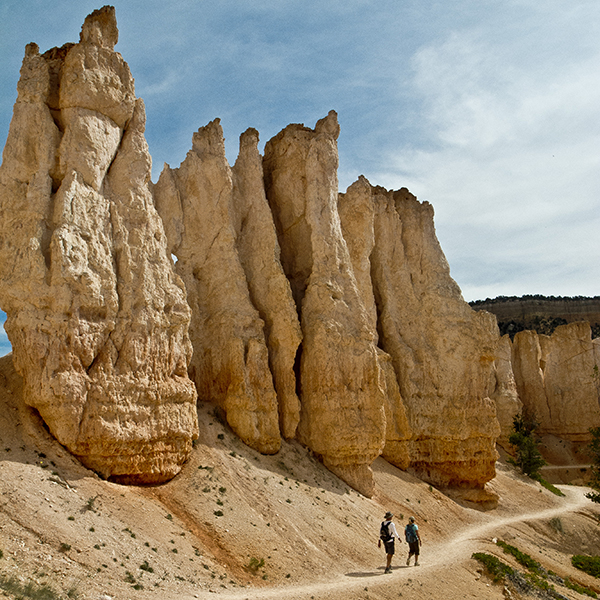
To hike the Fairyland Loop, follow the paved path from the road east toward Sunrise Point. When you reach the rim of Bryce Canyon, turn left and hike north along the gravel Rim trail. In 0.25 mile, veer right onto the Fairyland trail and begin a steep descent down a ridge. Limber, ponderosa, and bristlecone pine trees dot the slopes.
To Tower Bridge
The white, orange, and pink rocks in Bryce Canyon are part of the Claron Formation, whose beginning dates back about 55 million years ago. At that time, a freshwater lake covered south-central Utah, and the resulting lake and stream sediments formed alternating layers of limestone, siltstone, and mudstone. With varying hardness/softness of these rock layers, they erode at different rates forming the hoodoos that fill Bryce Canyon.
The grayish rock underfoot as you leave the rim is limestone, part of the White Member of the Claron Formation. As you drop down to the bottom of the amphitheater, you enter the Pink Member. Varying amounts of iron oxide impart the red, yellow, and brown hues.
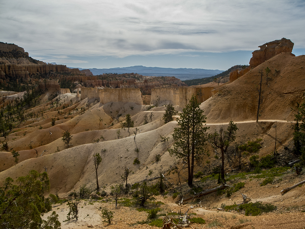
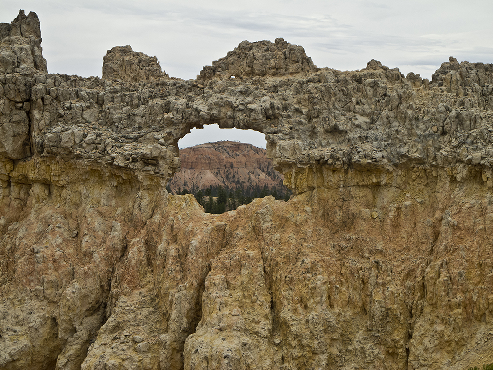
Around 0.9 mile, you pass a white ridge of hoodoos. Look to the south for views of China Wall, an impressive fence of hoodoos. The trail continues descending to the bottom of Campbell Creek. You cross the dry wash bottom a few times and arrive at a spur trail to Tower Bridge at 1.5 miles. The short trail (0.2-mile round trip) veers right and ends at a viewpoint of Tower Bridge, a natural formation you can also see from the main trail.
Below Boat Mesa
From the Tower Bridge junction, the main trail veers left and climbs above Campbell Canyon. For the next few miles, the trail undulates as it contours along the ochre slopes below Boat Mesa.
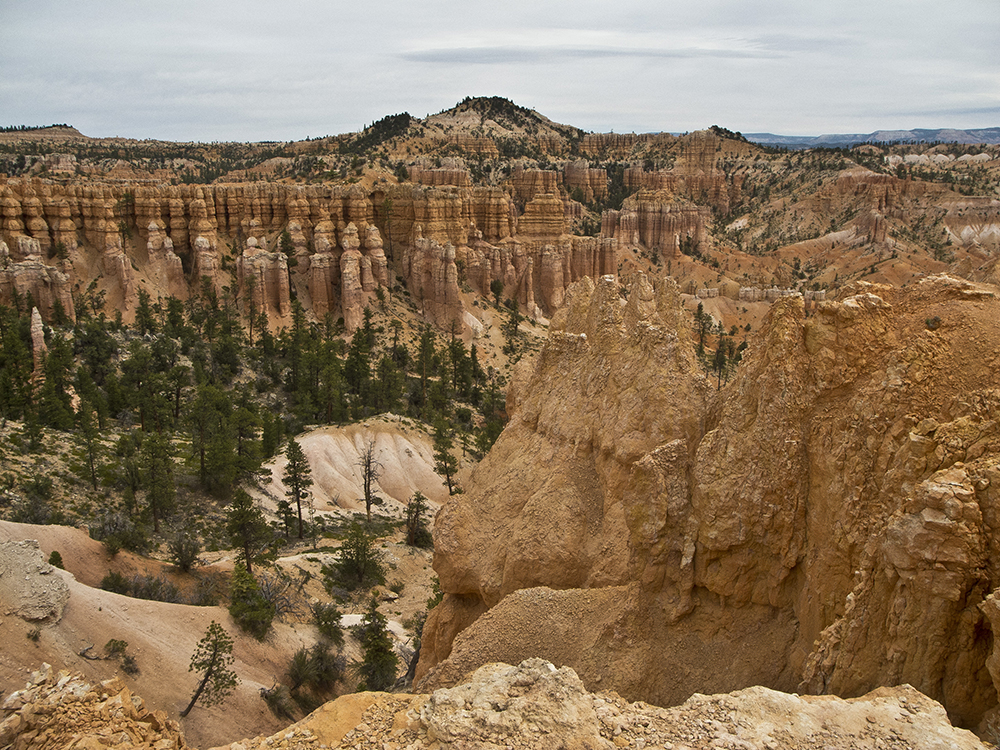
The slanted rock you see to the east is called Sinking Ship. Beyond that, you can see the Table Cliffs and Powell Point. Perspective of the hoodoos changes at the southeast corner of the loop when you begin a descent to the low point of the hike. Near 4 miles, you bottom out at 7,125 feet elevation near the floor of Fairyland Canyon. Now you are looking up at the tall spires instead of gazing at them from across the amphitheater.
The trail winds up, down, and around for a short distance, before starting a long and steady climb back up to the rim. During this climb, your back is mostly turned to the colorful amphitheater. But when you reach Fairyland Point at 5.3 miles, an incredible vista awaits. A wooden fence lines the rim, with a parking area to your right.
Along the rim
Turn left at Fairyland Point, continuing southwest along the Rim trail for the next 3 miles. The trail winds behind Boat Mesa and gradually climbs over the top of a knoll. Around 7.8 miles, you reach the junction where you branched off on the Fairyland trail. The parking spot is about 0.25 mile from here.
Directions to the trailhead
From the park visitor center, continue past North Campground and turn left towards Sunrise Point. When you see the green roofs of Bryce Canyon Lodge, veer left towards Sunrise Point and the General Store. Park along the road near the Sunrise Point Shuttle Stop. If taking the park shuttle, get off at Sunrise Point.