Branch off the main corridor trails in Grand Canyon National Park to find seclusion in Clear Creek.
The roundtrip hike to Clear Creek requires a four-day backpacking trip — one day to get down to Bright Angel Campground, another day to get to Clear Creek (described here), and an additional two days to retrace your steps back to the rim.
If you’re staying at the campground or Phantom Ranch for more than one night, you can day hike a few miles up the Clear Creek trail, enjoy fantastic canyon views, then return to camp. You must get a backcountry camping permit through the Backcountry Office.
Note: all mileages in this description are from the Bright Angel Campground.
Hiking the Clear Creek trail
After getting a good night’s rest at Bright Angel Campground, begin up the North Kaibab Trail past Phantom Ranch. Stroll along Bright Angel Creek until you reach a trail junction around 0.8 mile where you turn right onto the Clear Creek Trail. You immediately start climbing up the side of a gully, switchbacking to a saddle.
Every step in the canyon affords astounding scenery, and this trail is no different. The view from the saddle overlooks Bright Angel Canyon, the craggy inner gorge, and the layers of limestone, shale, and sandstone that stack up one vertical mile to the South Rim. Compared to the park’s main corridor trails (South Kaibab, Bright Angel, North Kaibab), this backcountry route is more rugged, exposed, and narrow.
The trail continues southeast, curving around a basin up a steady grade. A long switchback leads to Phantom Overlook at 1.4 miles, a landing area built by the Civilian Conservation Corps around 1935. Their trail reinforcements still hold today, along with two stone benches they built into the cliffs. Views surround you in all directions — try to spot hikers on the South Kaibab Trail to the south, and scan the creek to the west to find the brown roofs at Phantom Ranch. If you’re day hiking, continue another half mile up the trail for even better vistas.
Past Zoroaster and Brahma Temples
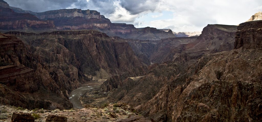
As you leave Phantom Overlook, the trail turns north in a sharp switchback up Bright Angel Canyon. The steep grade mellows as you curve around the base of the Tapeats Sandstone into the main river corridor, where a striking panorama of the Colorado River awaits.
From here on, the trail mostly contours above the river as you head east. You hug the cliffs for about a mile heading towards Sumner Butte. The trail climbs to the top of the Tonto Platform as it crosses Sumner Wash; cairns on both sides of the trail signify that camping is allowed east of this point.
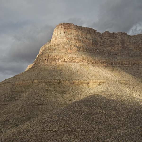
With the river now out of sight, Zoroaster Temple dominates the landscape. A white pyramid caps the hollowed crimson walls that end at Bradley Point to the east. The trail crosses several minor drainages over the next few miles as you contour along the Tonto Platform.
The red cliffs bend around to another promontory, Demaray Point. While you can see the Clear Creek drainage ahead of you, much stands between you and your destination — 4 miles, a canyon, and drainage are hidden in what looks like a great chasm. The trail turns north at Demaray Point and heads towards Brahma Temple, the rounded white crown set amongst the red cliffs in the distance. You parallel Zoroaster Canyon, crossing at its head and continuing east along the Tonto Platform. Wind around one last drainage near 7.5 miles before you descend into Clear Creek.
Down slippery slopes to Clear Creek
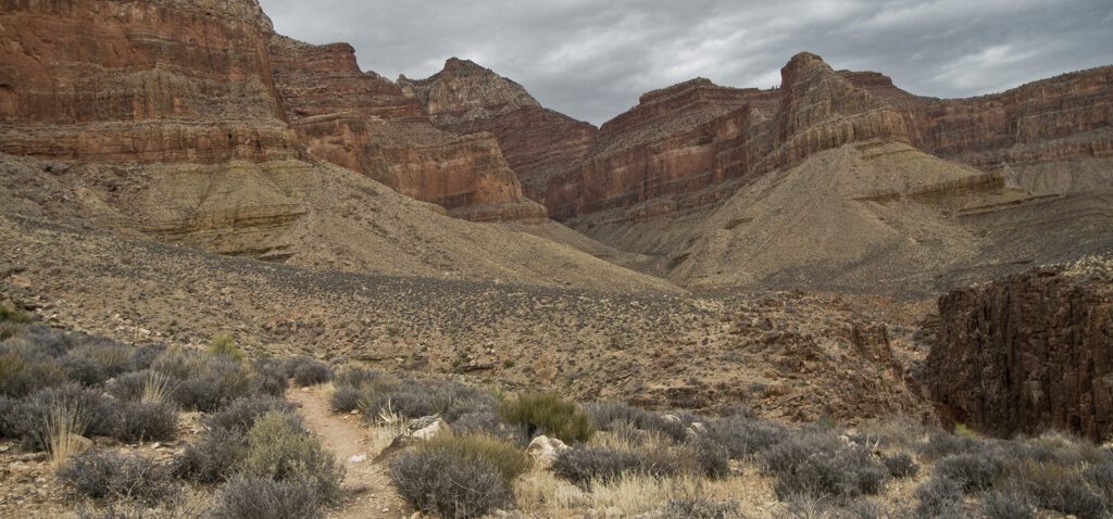
The trail turns north, briefly paralleling Clear Creek. You start your final descent around 9 miles with switchbacks leading down slopes of Hakatai Shale to the creek bottom. This red-orange rock gets its fiery color from oxidizing iron minerals. The last few switchbacks involve the most exposure of this whole hike—loose scree slides beneath you on a trail that is only as wide as your foot.
When you reach the bottom, the trail spits you into a dry creekbed. Continue downstream a few hundred feet to the confluence with Clear Creek. Along the way, you pass a composting toilet tucked deep in vegetation on the right creek bank. Cottonwood trees shade several campsites on the bench above the creek. Be sure to filter water from Clear Creek before drinking.
Some people choose to continue another 5 miles upcreek to Cheyava Falls, which flows in wet years, or another 6 miles downcreek to the Colorado River. Check with the park service for exact mileages, current conditions, water reliability, and trip reports.
Directions to the Clear Creek Trail
The Clear Creek trail starts at the bottom of the Grand Canyon, so you must use one of the park’s three rim-to-river trails to access the trailhead. You can start from the North Rim and hike down the North Kaibab Trail, or opt to begin at the South Rim and use either the Bright Angel or South Kaibab trails.
General Location Grand Canyon National Park, 65 miles northwest of Flagstaff, Arizona
Distance 9.4 miles (15 km)
Difficulty Strenuous
Trailhead Elevation 2,400 feet (732 m)
Highest/Lowest Elevation 4,200/2,400 feet (1280/732 m)
Fees Park entrance fee required. Backcountry permit must be obtained for an additional fee. See the website listed below for current information.
Pets Not Allowed
More Info NPS website
Adventure awaits
Sign up to get three hikes in your inbox every month for a year.

Special membership offer
Join the Grand Canyon Trust today to receive your adventure kit:
- $25 donation: a Grand Canyon map, The Advocate magazine subscription, bookmark, and sticker
- $75 donation: everything above plus four stunning note cards
- $100 donation: all the benefits of the $75 level, plus a Grand Canyon Trust hat
Related Hikes by Destination

Distance: Up to 13 miles
Difficulty: Easy
Type: Point-to-point

Distance: 6.6 miles (10.6 km) one way
Difficulty: Moderate
Type: Out and back

Distance: 9.5 miles (15.3 km)
Difficulty: Strenuous
Type: One way

Distance: 27.9 miles
Difficulty: Strenuous
Type: Out and back