See colorful rock formations on the Chimney Rock Trail in Capitol Reef National Park
Attention all road-trippers! If the kids are pestering each other in the back seat and you need to stretch your legs, pull off the state route for this short hike.
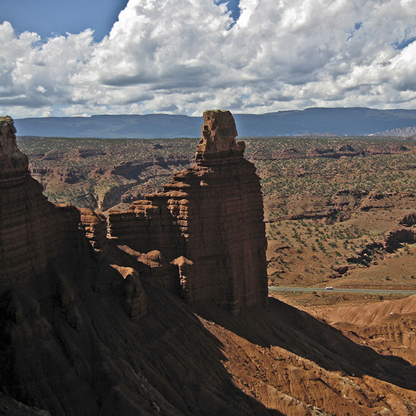
Leaving from the north side of the parking area, a rock corridor leads you into an open valley with juniper trees and shrubs stippling the ground. The 300-foot turret, Chimney Rock, stands to your right.
Steep climb to the top of the rim
As you make your way across the valley to the grayish-mauve slopes of Chinle shale, you begin your ascent along a fault zone. The rocks to the left of Chimney Rock are several hundred feet lower, a difference seen in the bright white layers at the base of the climb. These rocks are part of the same layer that caps the very top of Chimney Rock and shows the vertical displacement that has occurred from faulting.
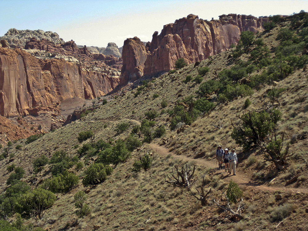
The trail climbs a steep grade, leaving the parking area and highway both behind and below you. Boulder Mountain rises in a high gentle curve on the southern horizon. Switchbacks on the trail help ease the climb, and after gaining about 500 feet you reach a trail junction. From this point, you can follow the loop in either direction. Turning right takes you counterclockwise around the mesa, frontloading the hike with climbing. Enjoy a leisurely coast downhill though, as you eventually hook back around.
Loop around the mesa
Continuing counterclockwise along the trail, switchbacks lead up and to the right. From here, you follow the rim of the Mummy Cliffs around the mesa with excellent views in all directions. A short spur trail to the right brings you closest to Chimney Rock.
You can follow UT 24 down below as it stretches east into Fruita and or west into Torrey. In fact, this road helped lead to the establishment of Capitol Reef National Park. Early residents of Wayne County saw tourism potential in the Capitol Reef area as early as 1915. Pushing for “Wayne Wonderland Park,” they recognized the connection between parks, roads, and economic development. While Capitol Reef received national monument status in 1937, it took almost 35 years to gain full national park status. Paving UT 24 in the early 1960s helped facilitate the creation of Capitol Reef National Park in 1971.
The trail begins switchbacking down to the low point of a saddle at about 2 miles.
Drop into Chimney Rock Canyon
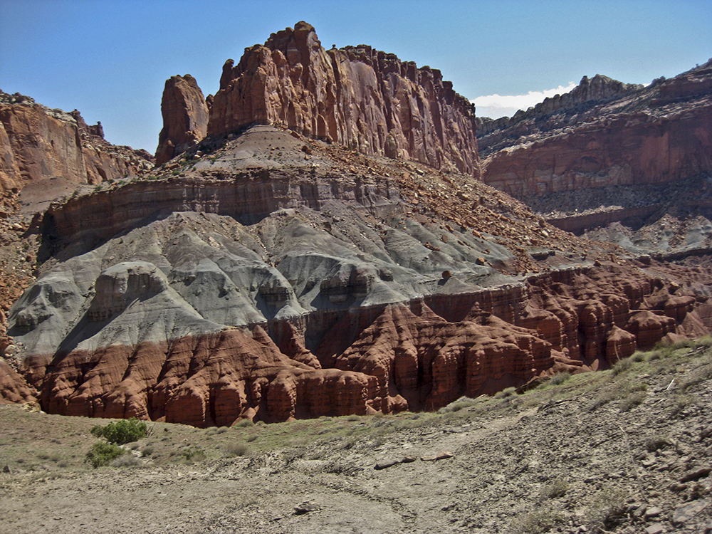
After crossing the saddle, the trail contours along the north slope of a hill. To your left, two sets of Wingate cliffs lie staggered behind each other—the nearest walls forming Chimney Rock Canyon and the deepest set of walls marking Spring Canyon.
As the trail drops, it veers northeast and heads away from UT 24. The talus Chinle slopes should look familiar by now, their rainbow of muted colors due to varying minerals and a conglomerate of pebbles, mudstones, charcoal, and shale.
A short climb up a hill puts you at the base of expansive Wingate walls. Boulders that have broken off the canyon walls clutter the slope leading down to the bottom of Chimney Rock Canyon. At the bottom of the drainage, the trail turns west and reaches a wooden sign close to 3 miles. Hang a left at this junction to return to the trailhead.
Cairns help mark the trail through Chimney Rock Canyon as you hike over talus slopes, cross side drainages, and follow meanders. Soon you complete the loop and rejoin the portion of trail where you started, then it’s back to the trailhead to finish your hike.
Directions to the trailhead
From the park visitor center: Drive 3 miles west on UT 24 and turn right into the Chimney Rock trailhead parking area.