Hike the Escalante Route in the Grand Canyon — the views are worth every step.
The Escalante Route is steep, exposed, and can roast you alive. But it is one of the most beautiful and rewarding backpacking trips in the Grand Canyon.
This is a recommended 3-day backpacking route and requires a Grand Canyon National Park backcountry permit. Learn more
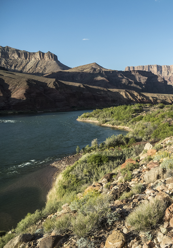
Hike down the Tanner Trail to the Colorado River, and look for a rock-lined path that cuts across the beach. Follow it downriver for about a half mile, where a cliff at the river’s edge forces you up on a bench. Continue downstream, traversing across the red Supergroup slopes and crossing a few small gullies. Around three miles, you reach Cardenas Creek. Though usually dry, you can walk down the cobbled creekbed to access water at the Colorado River.
Note: It’s wise to top off your water here. The next water is an exposed, hot, and shadeless 6 miles away at the mouth of Escalante Creek.
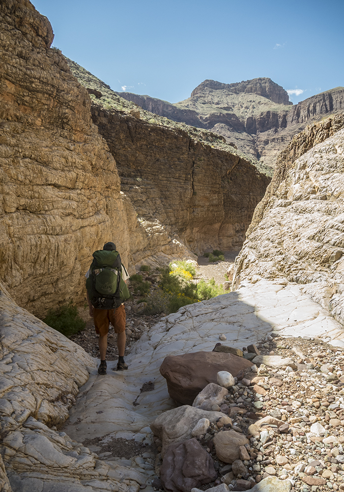
Cardenas Creek to Escalante Creek
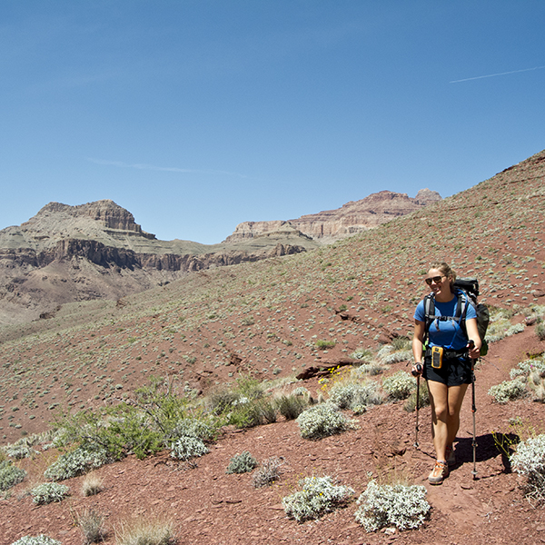
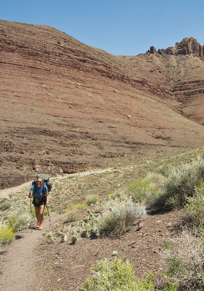
From Cardenas Creek, you’ve got a steady 3.5 mile climb ahead of you. The trail winds up to an archaeological site called Hilltop Ruin, then turns south, working its way to the back of an unnamed drainage. From there, hike west across steep, exposed slopes to the top of a ridge — a perfect snack spot with panoramic views of the Furnace Flats.
After crossing the ridge, you descend into Escalante Creek (also dry). The trail crosses the main drainage and continues dropping into its south arm, where you bypass a pouroff and follow the creekbed to the banks of the Colorado River.
Escalante Creek to Seventyfive Mile Creek
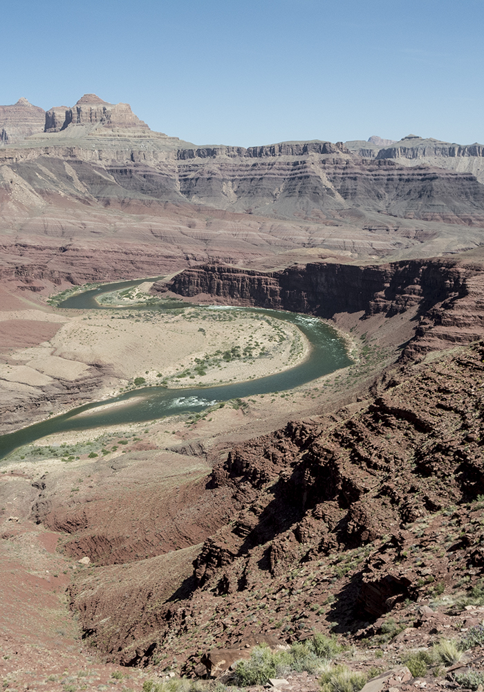
Sheer cliffs at river level again force you to climb up a series of ledges. Hike down river until you reach Seventyfive Mile Canyon. Turn south, and follow the rim for about a half mile until you can safely drop into the creekbed. Seventyfive Mile Canyon is spectacular — savor the walk through its narrow quartzite walls all the way to the Colorado River.
Seventyfive Mile Creek to Hance Rapid
From the beach at Seventyfive Mile Canyon, a cairned high route allows you to traverse down canyon. The pattern should feel familiar by now, as you momentarily drop down to river level at the mouth of Papago Creek only to climb up the cliffs again.
Note: At the Papago beach, cairns mark several routes up a series of sheer ledges. There are good hand and foot holds, but there is significant exposure for about 35 feet. Depending on your comfort level, a rope might be handy for hauling packs.
The grade eases, and you find yourself on a well-trodden trail about 300 feet above the river. But the easy walking doesn’t last long. When you reach a rock-filled gully, carefully pick your way down the steep boulder slide, being mindful of where you are in relation to others in your group.
The trail bottoms out on the brushy banks of the Colorado River, and it’s an easy half-mile walk to the mouth of Red Canyon and Hance Rapid.
From there, you can finish your trip by hiking out the New Hance Trail, or continue west on the Tonto Trail.
Directions
Since the Escalante Route starts 5,000 feet below the rim, driving to the start of the trail is not an option. You must get there by foot. See the Tanner and New Hance trails for more information.
Trip planning/logistics
This is a multi-day backpacking trip in Grand Canyon National Park, so you’ll need a permit to camp below the rim. Need help figuring out permits? We can help ›
Suggested itinerary:
- Day 1: Hike down Tanner Trail, camp at (BB9)
- Day 2: Hike along Escalante Route, camp at Seventyfive Mile Creek (BC9)
- Day 3: Continue down Escalante Route to Hance Rapid, than hike out New Hance Trail