Pass two arches and cross delightful slickrock benches on your way to Corona Arch
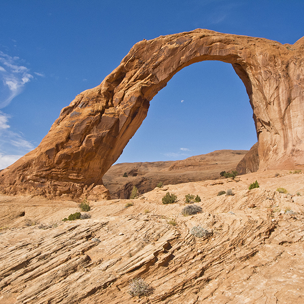
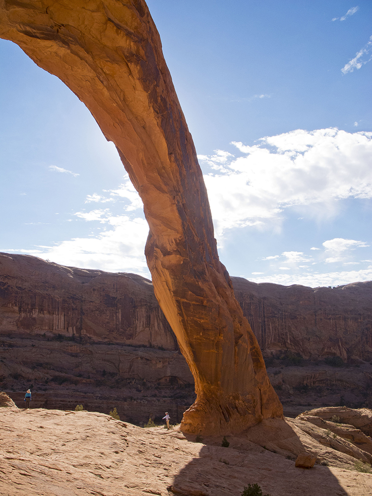
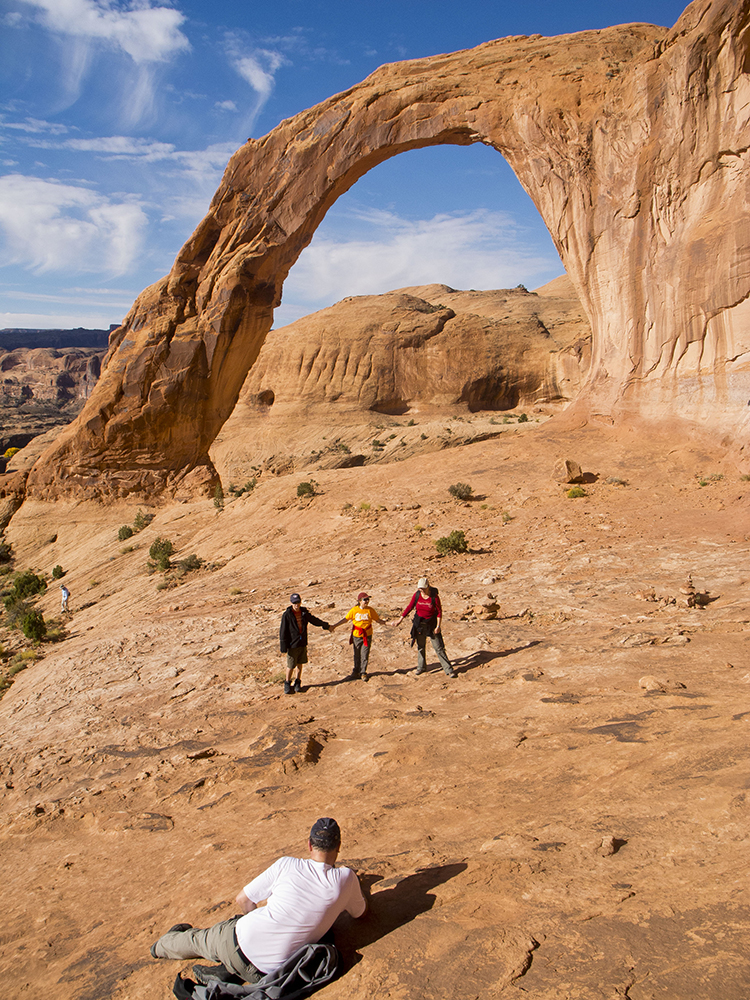
The Corona Arch hike is a Moab classic. See the 140-foot-wide and 105-foot-tall arch for yourself.
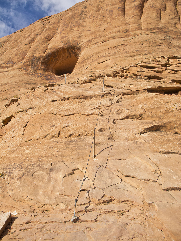
Note: There are two places where cables have been placed to assist hikers on short steep sections of the trail. There is also a short ladder.
After you cross the highway, follow the trail as it climbs to the top of a debris slope and crosses the railroad tracks that go to a large potash mine a few miles down the Colorado River. Potash is a mineral containing potassium that is used in fertilizers. Originally, potassium was derived from plant ashes soaked in a pot of water, hence its name.
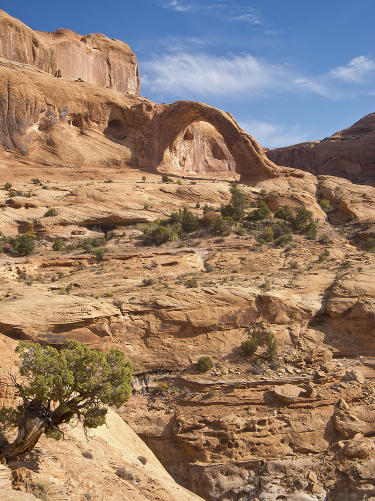
After crossing the tracks, the trail goes up an old eroded road bed to the top of a sandy mesa. It then heads northeast towards a cliff; if you look closely, you can see Pinto Arch in the wall of a large bowl on the left side of the trail. It can be hard to see depending on the light because sandstone, rather than sky, is visible through it. The trail leaves the sand behind and curves right across a broad swath of slickrock, where it cuts left around a towering point of the cliff. Notice the rounded, multicolored rocks scattered across the slickrock. These were deposited long ago when the Colorado River was up at this level, rather than where it flows today.
First view of the arch
After going through a shallow saddle, the trail descends a bit and you come to a cable handrail that crosses a steep section of slickrock. Soon after passing the cable, you get your first view of Corona Arch across a large bowl carved out of the Navajo Sandstone. Bowtie Arch is also visible to the left of Corona Arch. From here, the trail loops around the bowl on a series of sandstone benches along the base of the cliff. Within a few hundred yards you reach another cable — and some carved steps — that climb steeply up the rock. At the top of the cable and steps, the trail hooks right and goes to a short ladder that reaches the broad ledge that goes around the bowl to Corona Arch.
As you work your way around the bowl you will go by, almost under, Bowtie Arch, which is radically different from Corona Arch. Rather than a freestanding arch, Bowtie was created by water percolating down through the sandstone above an alcove, so the opening is in the roof and the front part of the alcove forms the arch. The water seeping out of the rock supports a small “hanging garden” — such spots of greenery are signature elements of the Colorado Plateau’s canyon country.
A few hundred yards past Bowtie Arch, you reach Corona Arch, which is a particularly graceful structure that also exudes a sense of solidity and strength. It does not feel like it will collapse anytime soon. Be sure to spend time viewing it from a variety of perspectives. If you go past it, you can look into the upper part of Bootlegger Canyon and into a neighboring large amphitheater of smoothly rounded sandstone. When you are done being mesmerized by sandstone silhouetted against the sky, return the way you came.
Directions
From downtown Moab, go north on US Highway 191 about 4 miles to the junction with UT 279 (just before the entrance to Arches National Park). Turn left and follow the road downstream beside the Colorado River for about 10 miles until you reach the Gold Bar parking lot. The trailhead is located in the first small parking lot upstream from the large parking lot with shade ramadas and pit toilets.