In Canyonlands National Park, you have an entire wilderness at your beck and call, but go prepared for big, empty country.
The Colorado and Green rivers have carved Canyonlands National Park into a complex network of deep chasms, towering spires, and vertical cliffs. From rafting, to mounain biking, to backpacking, Canyonlands has adventures for all.
Visiting the park
The park is divided into three districts named for their distinct features: Island in the Sky, the Needles, and the Maze. A detached unit to the west of the main park, Horseshoe Canyon, boasts one of the most significant rock art panels in the country. Dozens to hundreds of miles separate the districts by road, so if traveling by vehicle, you might need to pick and choose the places you visit! Backcountry camping requires a permit. Find out how to navigate the permit system
Island in the Sky District
Towering above the Colorado and Green rivers, Island in the Sky is a flat mesa covered with rolling grasslands, scattered forests of piñon and juniper, and expanses of slickrock. Thousand-foot-tall Wingate Sandstone cliffs provide stunning views of the Canyonlands country, both inside and outside the park. A paved highway runs down the spine of Island in the Sky, affording access to numerous viewpoints and hikes.
The southern tip of Island in the Sky, called Grand View Point, provides one of the most spectacular views on the Colorado Plateau, encompassing more than 6,000 square miles. The White Rim Trail, one of the most popular mountain bike rides in the area, wraps around Junction Butte below the point.
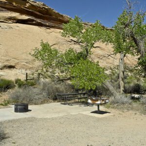
A visitor center is located 2.5 miles from the entrance to the park near “The Neck,” a narrow isthmus of rock that links the Island in the Sky to the surrounding mesas. There is a campground at Willow Flats with 12 sites available on a first-come, first-serve basis. Water is available at the visitor center seasonally, but nowhere else in this district.
Trails: Neck Spring Loop | Upheaval Dome Trail | Murphy Point Overlook
The Needles District
Eroded red and white spires of Cedar Mesa Sandstone give the Needles District its name. But it is much more than just the spires. Open grassland parks, frequently adorned with wildflowers, are scattered among rounded sandstone buttes, and deep canyons with green ribbons of vegetation along the streambeds provide contrast to the panoramic vistas found in much of this district.
The Needles District is a hiker’s heaven, with numerous loop hikes, day hikes, and backpacking opportunities. Several backcountry campsites can be reserved. There are also several 4WD roads that access other backcountry campsites.
A visitor center is located about a mile from the entrance. It has exhibits, a video, bookshop, pay telephone (there is no cell phone coverage in the Needles District), restrooms, and water. Water is also available at the campground, which has 26 sites on a first-come, first-serve basis. The campground typically fills up from late March through June and again from early September to the middle of October. There is a commercial campground outside the park near the entrance.
Trails: Confluence Trail | Slickrock Trail | Druid Arch Trail | Chesler Park | Big Spring Canyon Trail | Lost Canyon Loop Trail | Salt Creek
The Maze District
Remote, solitary, and primitive—all are words that capture the Maze District. While the Maze itself is a puzzle of interlocking canyons that provide almost limitless possibilities for exploration, simply getting there can be an adventure. The chapter titled “Terra Incognita: Into the Maze” in Edward Abbey’s book, Desert Solitaire, provides a great description of descending the Orange Cliffs on the Flint Trail on the way to the Maze. Even though Abbey wrote that chapter more than 40 years ago, the Flint Trail remains one of the most challenging and precipitous 4WD roads on the Colorado Plateau.
Hans Flat Ranger Station is the “visitor center” for the Maze District. Getting there from Moab requires driving 74 miles of paved highway, then 46 miles of dirt road. Permits for overnight trips in the Maze District are sold at the ranger station, as are some books and maps. No water, food, or gas is available along the way or at the ranger station, so go fully prepared. There is no entrance fee for the Maze District. There are two campsites for vehicles at the Maze Overlook. Reservations for the Overlook and other backcountry campsites can be made online at the Canyonlands National Park Backcountry Reservation System website
Horseshoe Canyon
A rock art panel known as the Great Gallery is located in Horseshoe Canyon, a small isolated unit of the Canyonlands National Park. The enigmatic, ghostlike figures painted on the canyon walls were originally thought to be 2,000 to 4,000 years old, but recent research now places their creation at 1,000 to 2,000 years ago. Whatever the age, this panel is one of the most significant archaeological sites in North America. The hike to the Great Gallery from the parking lot on the rim of Horseshoe Canyon is 7 miles with a descent of 780 feet. There are no services or water available in the Horseshoe Canyon unit.
Colorado and Green Rivers
Upstream of the confluence of the Colorado and Green rivers, neither river has rapids, so they are great choice for quiet, serene float trips. Below the confluence though, the Colorado enters Cataract Canyon, a world-class stretch of whitewater including the famed Big Drops. Most trips launch at Ruby Ranch or Mineral Bottom on the Green River, or Potash and Moab on the Colorado.
If the trip does not include the whitewater of Cataract Canyon, boats and gear must be ferried back upstream by jet boat since there is no road to the confluence. Permits are required for all river trips in the national park. Potable water is not provided anywhere along the rivers. Boaters must be self sufficient, and carry a cleanable, reusable toilet system.
General Location Southeastern Utah
Closest Towns Moab, Utah
Cost Vehicle Permit: $30 (check the website below for current information)
Managed By National Park Service
Pets Pets are NOT allowed at overlooks, on any hiking trails, anywhere in the backcountry, on the rivers, or on any backcountry roads, even if it stays in your vehicle
More Info NPS website
Adventure awaits
Sign up to get monthly hikes in your inbox for a year.

Special membership offer
Join the Grand Canyon Trust today to receive your adventure kit:
- $25 donation: a Grand Canyon map, The Advocate magazine subscription, bookmark, and sticker
- $75 donation: everything above plus four stunning note cards
- $100 donation: all the benefits of the $75 level, plus a Grand Canyon Trust hat
Related Hikes by Destination

Sites: 25
Season: Open year-round
Reservations: For groups sites only

Distance: 8 mi (12.9 km)
Difficulty: Easy
Type: Out and back

State: Utah
Nearest Town: Springdale, Utah

Distance: 2.2 mi (3.5 km)
Difficulty: Moderate
Type: Out and back

