
Pronghorn and barbed wire fences don’t mix, but volunteers are working to change that, one wire at a time.
Map of the Month: meet the nerd behind the Trust maps for an insider glimpse into the world of cartography in this blog series.
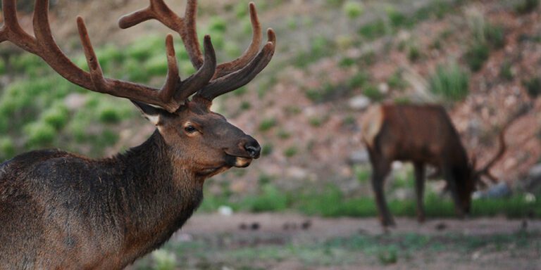
Pronghorn are large, hoofed mammals that live in the American West. They roam wide-open grasslands, like those in House Rock Valley, north of the Grand Canyon. Unfortunately, pronghorn evolved to run fast but not jump, so the miles of barbed wire cattle fences in House Rock Valley prevent their natural migrations. While barbed wire makes great cattle fences, it cuts off pronghorn and other small critters from reaching food and water. When pronghorn try to slide underneath, barbed wire scrapes their backs and can injure the animals.
So pronghorn and fences don’t mix, or can they?
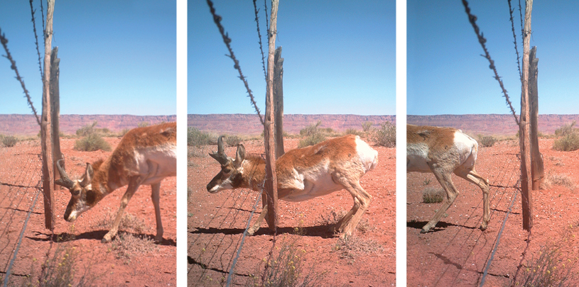
Researchers have found that by replacing the lowest strand of barbed wire with smooth wire and making sure it’s at least 18 inches off the ground, pronghorn can pass underneath the fence. Since 2011, the Grand Canyon Trust and over 200 volunteers have been modifying fences in House Rock Valley to allow pronghorn to pass under them. And the good news is, it works! Our wildlife cameras show pronghorn easily slipping through the bottom wire.
Mapping fence lines in House Rock Valley
View in fullscreen (suggested for mobile)
Year by year, mile by mile, we are fixing fences in House Rock Valley to be more wildlife friendly. To track our progress, we need a way to visualize which sections of fence we’ve already modified and which sections we have left to fix. Enter Geographic Information Systems (GIS).
GIS is mapping software that allows us to gather, manage, and analyze spatial data. In this case, we use GIS to track and analyze our work modifying pronghorn fences in House Rock Valley. We do this using a variety of field maps that allow our staff and volunteers to track their progress on each visit to the field.
Thanks to GIS, we know that Trust volunteers have modified nearly 24 miles of fences in House Rock Valley. Combined with the efforts of the Bureau of Land Management, Arizona Game and Fish, and other stewards in House Rock Valley, more than 66 miles of fencing have been modified for pronghorn and 10 miles have been removed completely.
Part Google map, part spreadsheet
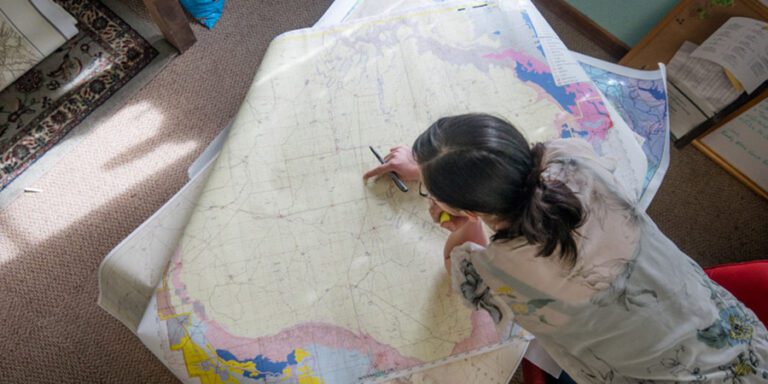
 Checking the map on a volunteer trip. LEONARD ROSEMAN
When pulled up on an iPad and carried in the field, this fence map helps staff and volunteers navigate to their work sites. They also can add updates to show where they’ve spent time working and which sections of fence they’ve modified. Think of this field map like a mix between Google maps and a spreadsheet — you use it to get where you want to go, but you also record what you did while you were there.
Once a volunteer trip is done, I update our field maps for the next trip and share our work with our partners. This way, information travels directly from the field, to the map, to the team of people working to improve wildlife routes through House Rock Valley.
By incorporating field maps and field data collection practices, we can continuously record our progress. These ready-made tools allow us to pick up where we left off and focus our time and energy on fixing more fences for pronghorn.