An easy walk to the Murphy Point Overlook, with vistas of the the Green River
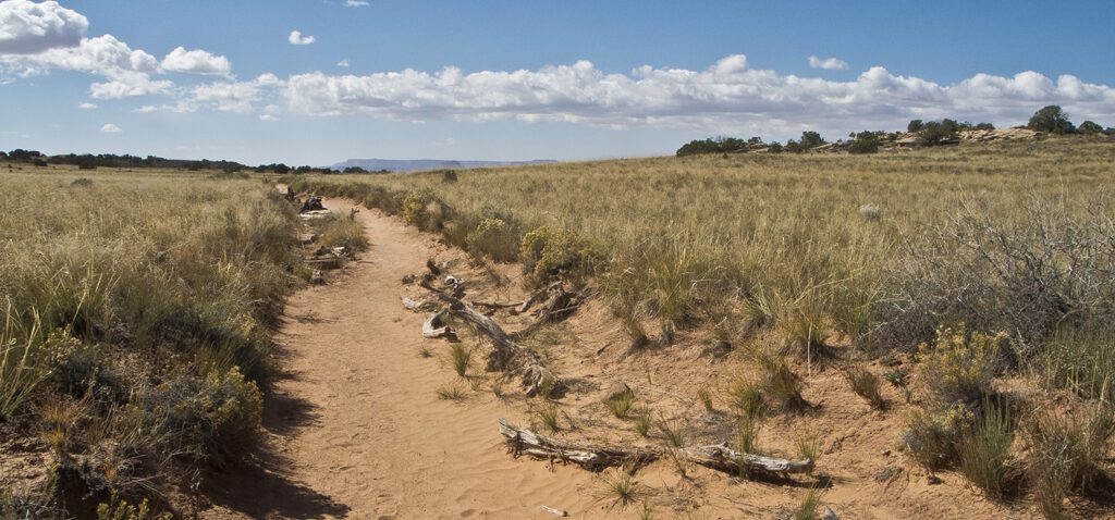
The hike to Murphy Point Overlook crosses, sand, hills, and slickrock.
This easy walk begins on the west side of the parking area, and cuts southwest across a field punctuated by juniper and piñon trees. The Henry Mountains rise ahead of you to the west, while distant cliffs near the Green River lure you down the trail.
After a quarter mile, you pass an old corral on your right and continue to a junction around 0.5 mile. Veer right towards Murphy Point Overlook, after which the trail climbs up and over several small hills. When the sandy trail gives way to slickrock, continue following cairns.
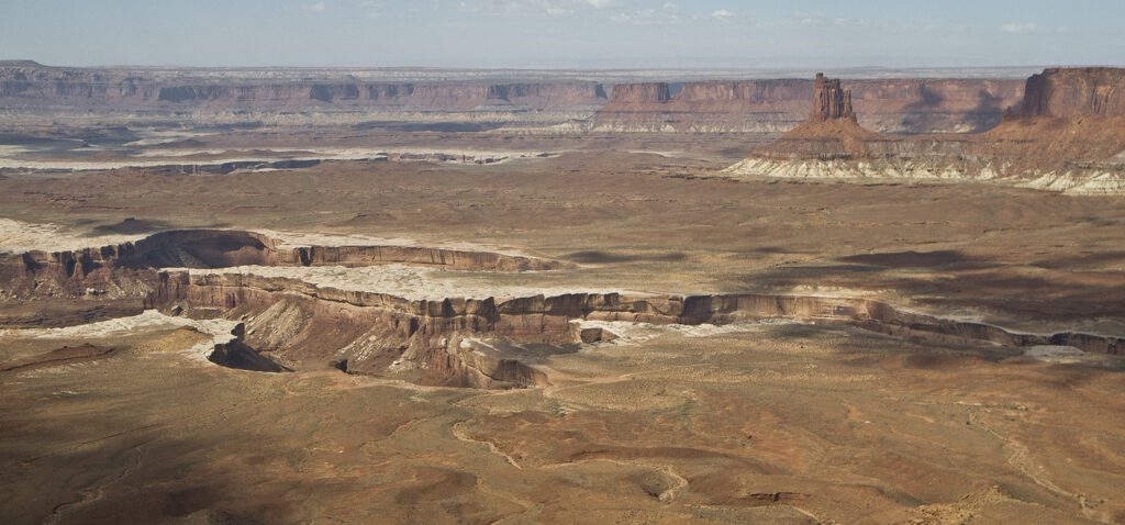
As you walk to the rim, prominent buttes, pinnacles, and cliffs of Wingate Sandstone rise from the Chinle Formation basin below. The White Rim Sandstone lines the Green River corridor like a bathtub ring. The namesake White Rim Road, a popular 100-mile loop, contours along this rock layer. You can trace the road below you and might even see dust plumes from vehicles or mountain bikers.
The trail ends at the overlook at the edge of a finger of sandstone. Panoramic views include the Henry Mountains, Green River, and several named features: Candlestick Tower to the north, Junction Butte to the south, and Cleopatra’s Chair to the west. You can also distinguish the intricate Maze District of Canyonlands National Park to the southwest.
When you’re ready to return, hike back the way you came.
Directions to the trailhead
From the visitor center in downtown Moab, drive 11 miles north on Hwy 191. Turn left (west) onto UT 313 and continue for 14.5 miles until you reach an intersection. Keep straight, merging onto Grand View Point Road and following signs to Canyonlands National Park (UT 313 turns left towards Dead Horse Point State Park). Reach the park visitor center in about 7 miles, and continue south on the road. Keep straight at the next intersection. The trailhead for Murphy Point is signed on the right. Pull into the dirt parking area. Backcountry camping requires a permit. Find out how to navigate the permit system ›
General Location Canyonlands National Park
Distance 3.4 miles (5.5 km)
Difficulty Easy
Trailhead Elevation 6,200 ft (1,890 m)
Highest/Lowest Elevation 6,200/6,040 ft (1,890/1,840 m)
Fees Park entrance fee required. Check the website below for current information
Pets Leashed pets are allowed on front-country roads and campgrounds.
More Info NPS website
Adventure awaits
Sign up to get three hikes in your inbox every month for a year.

Special membership offer
Join the Grand Canyon Trust today to receive your adventure kit:
- $25 donation: a Grand Canyon map, The Advocate magazine subscription, bookmark, and sticker
- $75 donation: everything above plus four stunning note cards
- $100 donation: all the benefits of the $75 level, plus a Grand Canyon Trust hat
Related Hikes by Destination
Distance: 3.4 miles (5.5 km)
Difficulty: Moderate
Type: Out and back
Distance: 9 miles (14.5 km)
Difficulty: Moderate
Type: Out and back
Distance: 12.4 miles (20 km)
Difficulty: Strenuous
Type: Loop hike
Distance: 15.6 miles (25.1 km)
Difficulty: Strenuous
Type: Loop hike
