Walk along the north rim of the Grand Canyon on the Widforss Trail
See the views that inspired artist Gunnar Widforss, who painted the Grand Canyon in the 1920s and 1930s.
Note: Be sure to check the dispenser at the beginning of the trail for a brochure that provides information keyed to 14 numbered posts along the trail.
The Grand Canyon is nowhere in sight from the Widforss trailhead. Instead, the trail leads southeast along the bottom of a ridge and skirts the edge of Harvey Meadow, which was the location of the an early tourist camp. “Uncle” Jim Owens, a game warden and avid mountain lion hunter in the early 1900s, lived in a small cave across the meadow.
In a few hundred yards, the trail curves to the right, goes up a couple of switchbacks, and wraps around the end of the ridge where you get your first view of the canyon through the trees. The trail climbs a few minor ledges of Kaibab Limestone, which was deposited 250 million years ago when the area was at the bottom of a warm sea that seethed with hard-shelled sea creatures. If you look closely, you may be able to see fossils embedded in the rocks.
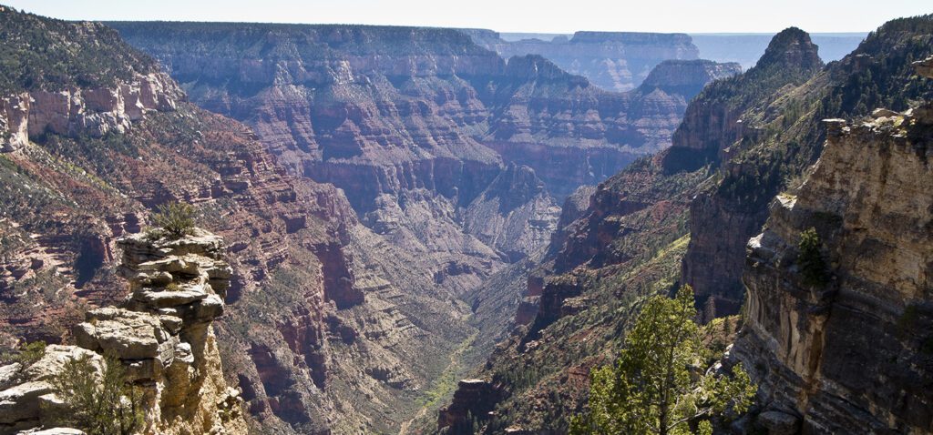
Great views of the Grand Canyon
At about 0.3 mile, the trail enters a small drainage and then climbs out to the top of the rim and along the edge of an area that burned in 2005. Fortunately the trail stays in unburned territory, and the big trees provide shade. They also nicely frame views of the Transept, the deep gorge immediately in front of you; Brahma and Zoroaster Temples in the main canyon; the South Rim; and the San Francisco Peaks, 70 miles away near Flagstaff.
For the next 2 miles the trail alternates between following the rim and going in and out of small tributaries of the Transept.
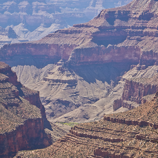
As the trail works around the head of the Transept, note the band of vertical white cliffs below the rim. This is the massive Coconino Sandstone, deposited as windblown sand dunes 270 million years ago. The red slopes below the Coconino are the Hermit Shale and Supai Group, deposited 285-315 million years ago, and below that is the cliff-forming Redwall Limestone, deposited 340 million years ago.
Toward Widforss Point
At 2.75 miles, the trail leaves the rim, and you don’t see the canyon again until you reach the end of the trail (another 2.25 miles) near Widforss Point. The trail goes along a valley floor lush with ferns and aspen. In about 0.5 mile, the trail curves left, goes up another valley towards the Transept, and then hooks right to climb out to a broad, flat bench.
Skirting a few pockets of burned trees, the trail wanders southward, and in a mile or so it begins to slowly descend. The vegetation becomes sparser, and you begin to catch glimpses of the main canyon and the South Rim. A few hundred feet from the end of the trail, you’ll see a picnic table.
The trail does not end at a clearly defined point like many canyon hikes. Widforss Point is the Kaibab Limestone knob across a small valley, but there is no clearly defined trail to it; most hikers just find a rock ledge to sit and absorb the view, which is tremendous.
You can see an unbelievable number of landmarks, including Yaki, Yavapai, and Mather Points on the South Rim, Wotan’s Throne, Horseshoe Mesa, Zoroaster and Brahma Temple, the San Francisco Peaks, and Buddha and Isis Temple. Haunted Canyon is just west of the trail with a thin line of riparian vegetation in the bottom. After trying to figure out the names of the plethora of features, return the way you came.
Read more about how to obtain permits for backcountry trips in the Grand Canyon