This is a popup dialog that overlays the main content of the page. The popup includes a search form to help you find the information you are seeking. Pressing the close button or using the escape key will close the popup.
A short walk takes you to a geologic mystery called Upheaval Dome
Scientists still debate its origin, but regardless of how it formed, Upheaval Dome is a sight you don’t want to miss!
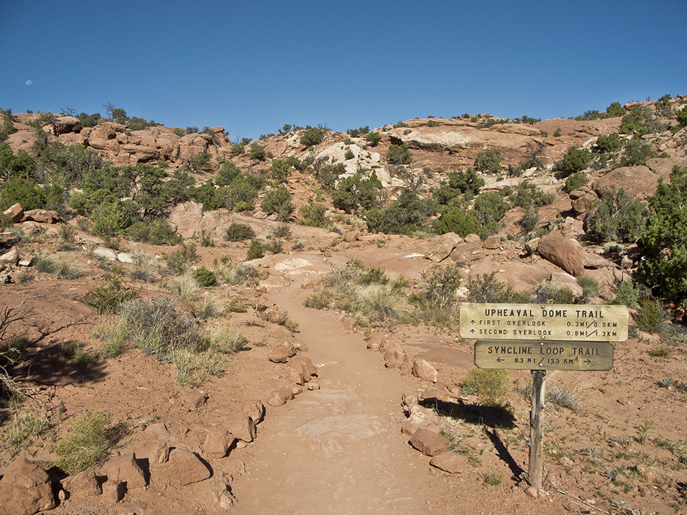
The trail begins on the northwest side of the picnic area near the informational board. Upheaval Dome Trail and Syncline Loop follow each other for several hundred feet, but when you reach a junction, continue straight towards Upheaval Dome. A steady climb continues all the way to the first viewpoint.
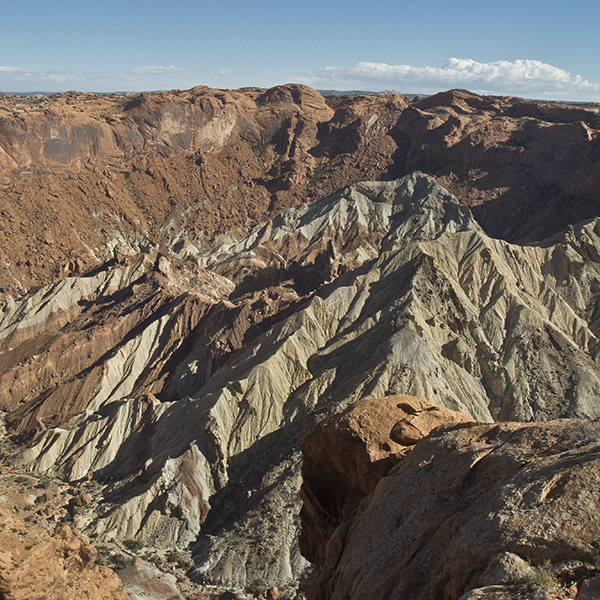
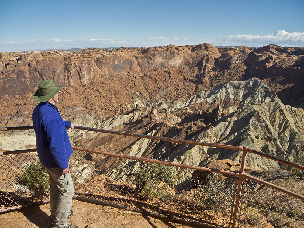
Glance behind you to see views of the park road, with the tops of the La Sal Mountains poking above the horizon on the east. Ahead, you walk past piñon trees, junipers, and Mormon tea. As you crest a hill, the trail continues on slickrock. Veer to the right when you see a sign for the first viewpoint, walking about 150 feet to the overlook and high point of the hike. Here, rock layers that are uniform throughout the rest of the park are thrust up into wildly upturned strata. The greyish dome in the center rises 750 feet from the floor, a giant belly button surrounded by a rust-colored rim.
Scientists debate Upheaval Dome’s origin. While opinions vary between two predominant theories of a slow moving salt dome or meteorite impact, recent evidence points towards the latter. In 2007, German scientists reported finding quartz crystals that were “shocked” by meteorite impact.
Retrace your steps back to the main trail, and continue west towards the second viewpoint. Follow a cairned route over rolling slickrock hills. When you reach a saddle, climb up and over the next dome. The trail curves northeast, shoots across to the crater rim, and reaches the second viewpoint around 0.8 mile. Return the way you came.
Directions to the trailhead
From the visitor center in downtown Moab, drive 11 miles north on Hwy 191. Turn left (west) onto UT 313 and continue for 14.5 miles until you reach an intersection. Keep straight, merging onto Grand View Point Road and following signs to Canyonlands National Park (UT 313 turns left towards Dead Horse Point State Park). Reach the park visitor center in about 7 miles, and continue south on the road. Turn right at the next intersection, and follow signs to Upheaval Dome. The trailhead is at the end of the road. Backcountry camping requires a permit. Find out how to navigate the permit system
General LocationIsland in the Sky District of Canyonlands National Park
Distance1.6 miles (2.6 km)
DifficultyEasy
Highest/Lowest Elevation5,800/5,600 ft (1,768/1,707 m)
FeesPark entrance fee required. Check the website below for current information
PetsLeashed pets are allowed on front-country roads and campgrounds.