A late 1800s mining route turned early 1900s tourist attraction. Today the New Hance Trail is a rugged backcountry rim-to-river route.
Every rim-to-river route in the Grand Canyon is steep, plunging a vertical mile into the bowels of the Earth. But the New Hance Trail offers a downhill grade like no other.
In just 6.5 miles, the trail drills through 4,400 feet of rock to the Colorado River.
A steep descent
From the trailhead, you waste no time descending through ledges of Kaibab Limestone and Coconino Sandstone. You might end up scrambling rather than stepping down the sharp drops.
Coronado Butte comes into view, and you reach its saddle around 1 mile. From here, the trail follows a major drainage along the butte’s eastern edge through the Hermit Shale. You continue along the dry wash, dropping down through the Supai Formation and weaving in and out of the creekbed. When the trail branches east, you begin a difficult 1-mile traverse through the lower part of the Supai. Eroded gullies force you to pick your way across numerous rock slides.
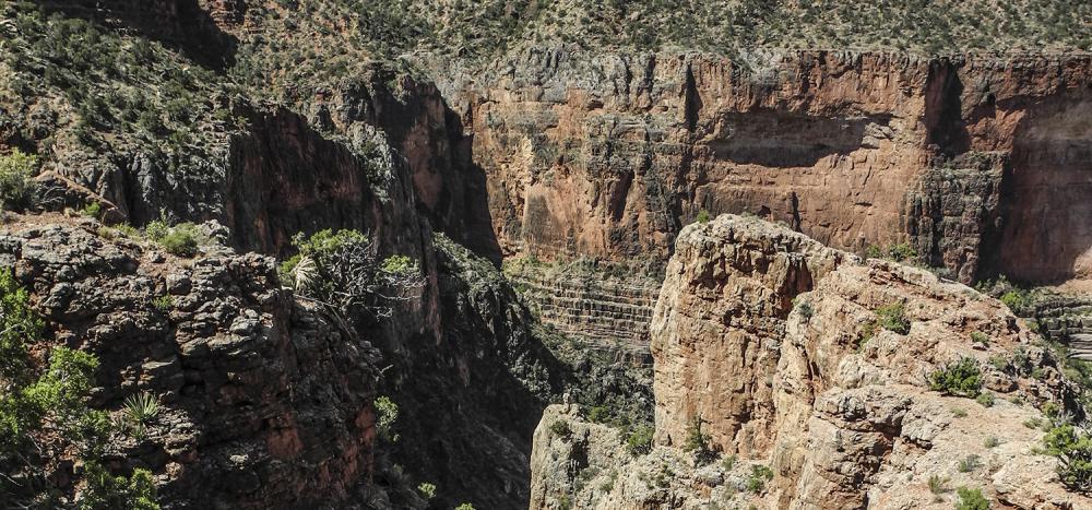
A fin at the top of the Redwall Limestone marks a break in the cliff band. Follow the cairns carefully down through the Redwall. At the bottom of the switchbacks, you begin a descending traverse on a ridgeline directly below Moran Point.
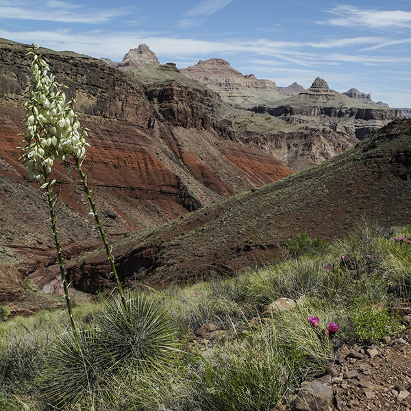
Through the Supergroup
After crossing a side drainage, you continue bending around the bright crimson slopes that give Red Canyon its name. These tilted layers of shales, siltstones, and mudstones are called the Supergroup and are not exposed everywhere in the Grand Canyon’s rock record.
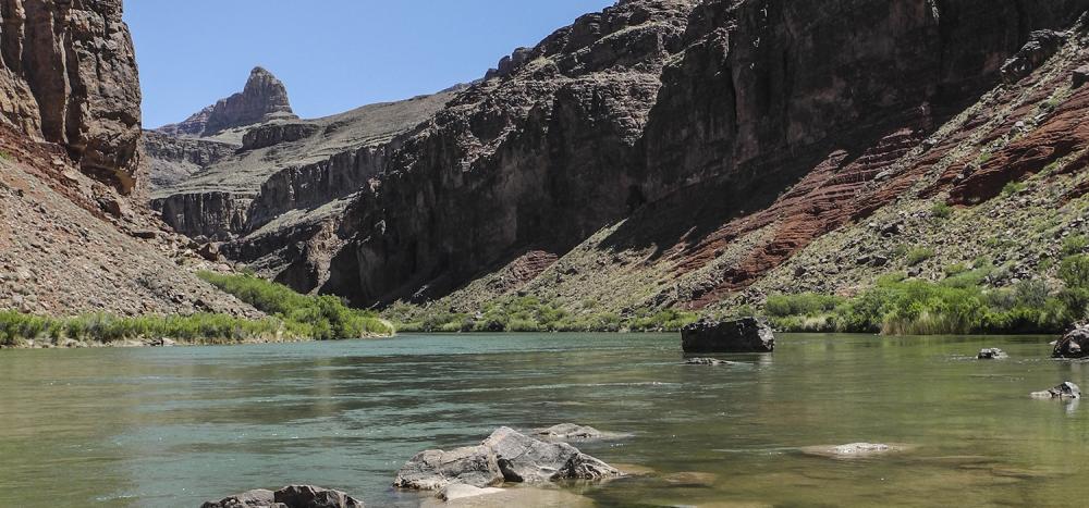
The trail reaches the bottom of Red Canyon around 4.9 miles. Continue another 1.6 miles along the creekbed to Hance Rapid at the Colorado River.
Note: The New Hance trail is usually used as part of a longer trek up or downcanyon. With a backcountry permit, you can camp at Hance beach. The next day, you can go back out the way you came or connect with the Tonto Trail heading west, or the Escalante Route heading east.
Directions to the trailhead
The New Hance Trail starts along Desert View Drive (Hwy 64), 1 mile west of Moran Point. You can reach the trailhead from either entrance station on the South Rim.
From Grand Canyon Village, drive 13 miles east on Hwy 64 (Desert View Drive). Look for the first road on the right past the Buggeln picnic area and park there. From the junction of Hwy 89 and 64 at Cameron, Arizona, drive west on Hwy 64 for 39 miles. Continue through the Desert View entrance, drive past Moran Point, and look for a road on the left. Drive down the short driveway and park your vehicle. From the parking area, walk about a half mile east on Hwy 64 to get to the trailhead.