Combine routes through two canyons for this excellent loop hike in the Needles District of Canyonlands National Park
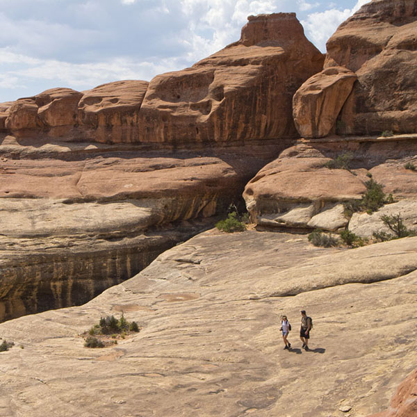
An excellent day hike in Canyonlands, Lost and Squaw Canyons offer broad slickrock views.
Immediately after leaving the parking lot, you reach a junction where the Big Springs Trail comes in from the right. Continue straight ahead on the Lost Canyon-Squaw Canyon Trail. Keep your eyes open for cairns. Note that the top of the bench is white sandstone, but when you drop into the Squaw Canyon drainage, you cross a section of red sandstone. The white sandstone was formed from nearshore sand dunes, while the red sandstone was formed from sand deposited in periodic rivers and lakes.
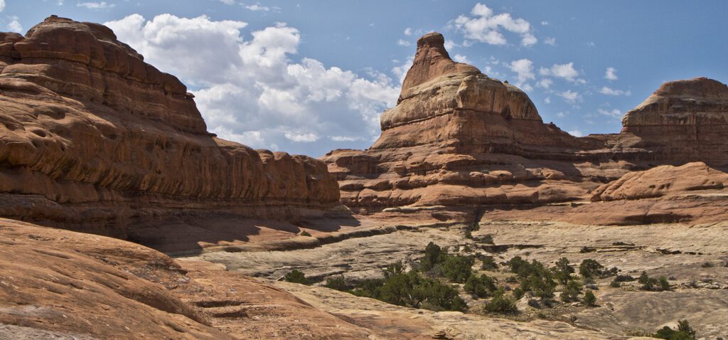
At about 1.1 miles, you reach a junction where the Squaw Canyon and Lost Canyon trails split. Go left on the Lost Canyon Trail, which ascends a grass-covered slope. The trail follows the base of a slickrock outcropping that eventually becomes a shallow canyon. You climb up a short, steep slickrock section to leave the canyon, and the trail soon bears right across another bench towards a prominent sandstone knob with a tower on the right side.
Next, you climb up a slope at the base of a tall sandstone butte to reach a saddle. Here you’ll have sweeping views back the way you came, as well as your first views into Lost Canyon. This is a great spot to stop and drink in the remarkable landscape making up this part of the park. The foreground is pure rounded, sensuous slickrock, the middle ground is either grassy parklands or tree-lined canyons, and the background is distant mesas, buttes, and blue-tinged mountains.
Leaving the saddle, you traverse a broad bench towards the east (look for cairns), where you reach a short ladder to drop onto some broken ledges into the canyon bottom. The trail follows the bottom of the canyon, a tributary of Lost Canyon, until it reaches the main drainage and a junction (2.6 miles) where you turn right up Lost Canyon.
Lost Canyon
The trail follows the streambed, and the soft sand makes walking a bit tough. Look for spots where the trail climbs onto terraces, which provide somewhat better footing. In about a mile, you reach pools of water. For the next few hundred yards, the trail stays above the riparian area on the south side of the canyon as it meanders back and forth. The trail then drops into the canyon bottom and through a large patch of wild roses. The trail is difficult to follow at times because of flooding, and because it goes in and out of the streambed and snakes through thick vegetation.
At about 5 miles, look for what appears to be a tributary (actually a cut-off meander) coming in from the right, where a trail climbs out of the canyon bottom, going to a backcountry campsite (Lost Canyon 3 or LC3). Immediately after the campground, the trail leaves the main drainage and goes up a side drainage on the right. The side drainage is considerably narrower than the main canyon. About 0.4 mile after entering the side canyon, you come to a large boulder with a steep set of rock stairs tucked behind it. This is where you begin your ascent out of the canyon. It is a bit of a scramble above the stairs, but you quickly reach a slickrock ledge well above the weedy bottom of the canyon. The trail goes left along the ledge towards a red, pyramid-shaped butte that dominates a white slickrock basin.
Squaw Canyon
Traversing across the basin (again watch for cairns), the trail heads directly towards the base of a butte. You climb switchbacks up to a solid slickrock saddle between Lost and Squaw canyons. This is the second saddle on this hike that provides stunning views in all directions. Six Shooter Peak, the Abajo Mountains, and hundreds of square miles of humped and domed slickrock cut by canyons are visible.
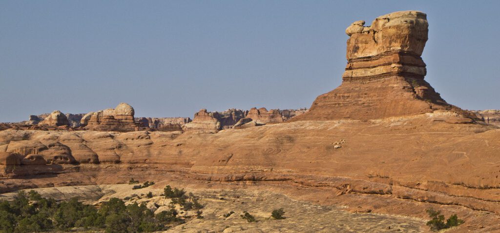
After savoring the views, you continue the hike along a ledge at the base of a massive sandstone butte that follows the contact point between the red and white sandstone. Follow the curving ledge and drop down to a drainage that is aimed directly at a rock pinnacle that looks like it has a fat owl sitting on top of it.
Immediately after crossing a creek, you reach a junction where you go right, heading downcanyon. According to the sign, it is 2.8 miles to the trailhead at the main Squaw Flat Campground. To extend the hike, you can turn left and go up the canyon, where you can hike the Big Springs Canyon Trail back to the campground.
Squaw Canyon is not as deep or as narrow as Lost Canyon. The more open canyon floor makes for easy walking, and the Cedar Mesa Sandstone, with its typical mushroom rocks, lines the canyon walls. A little less than a mile from the junction with the trail to Big Springs Canyon you will see the SC1 campsite on your left. As you walk down Squaw Canyon, it continues to widen, and finally you are walking across grass-covered benches. Soon, you reach the junction with the Lost Canyon Trail, where you started the loop portion of the hike. Go left to return to the Squaw Flat Campground Trailhead (1.5 miles) along the same trail you hiked earlier in the day.
Directions to the trailhead
Take Highway 191 south out of Moab, at about 40 miles turn west (right) onto UT 211, go another 34 miles to the Needles visitor center. Continue to the campground road, turn left and go straight (past the road on the right that goes to a second group of campsites) until you come to a parking lot on the left with a pit toilet and split rail fence. The trail goes through the fence at the right end of the small sandstone outcrop. Backcountry camping requires a permit. Find out how to navigate the permit system
General Location Canyonlands National Park
Closest Towns Moab, Utah
Distance 8.8 miles (14.2 km)
Difficulty Moderate
Trailhead Elevation 5,100 ft (1,555 m)
Highest/Lowest Elevation 5,450/5,000 ft (1,660/1,525 m)
Fees Fee required – Check the website below for current information
Pets Not Allowed
More Info NPS website
Adventure awaits
Sign up to get three hikes in your inbox every month for a year.

Special membership offer
Join the Grand Canyon Trust today to receive your adventure kit:
- $25 donation: a Grand Canyon map, The Advocate magazine subscription, bookmark, and sticker
- $75 donation: everything above plus four stunning note cards
- $100 donation: all the benefits of the $75 level, plus a Grand Canyon Trust hat
Related Hikes by Destination
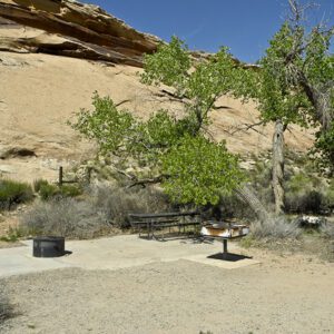
Sites: 25
Season: Open year-round
Reservations: For groups sites only
Distance: 8 mi (12.9 km)
Difficulty: Easy
Type: Out and back
State: Utah
Nearest Town: Springdale, Utah
Distance: 2.2 mi (3.5 km)
Difficulty: Moderate
Type: Out and back
