Hike to the Kachina and Owachomo Bridges in Natural Bridges National Monument
Drop into Armstrong Canyon at Kachina Bridge, then hike upstream to Owachomo Bridge.
Begin this hike by walking down the concrete sidewalk that goes to the Kachina Bridge overlook. In a hundred feet or so, you reach a junction and the trail to Owachomo Bridge takes off to the left, crossing a slab of slickrock as it goes towards the canyon. The trail wraps around an outcrop and goes past an alcove with a small juniper tree clinging to a crack in the rock, a great example of the tenacity of life in this arid rocky region.
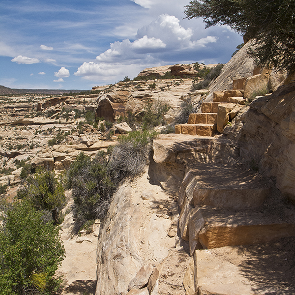
The trail reaches the rim of the canyon at 0.25 mile, and you get a view of Kachina Bridge as the trail descends several ledges and sandstone steps built by the Park Service. At 0.4 mile, you reach a junction; going right takes you to Kachina Bridge and going left takes you to Owachomo Bridge. If you take the 0.25-mile side trip to Kachina Bridge, you will need to return to this junction because a pouroff makes it impossible to walk up the canyon floor.
Going up Armstrong Canyon
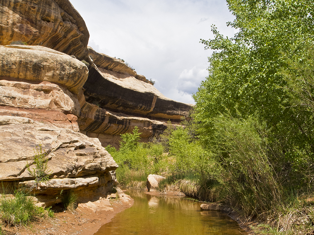
After turning left at the junction and heading for Owachomo Bridge, the trail passes a large pouroff named “Knickpoint.” Usually there is a deep pool of water at the bottom of the pouroff. After the pouroff, the trail follows the flat, sandy streambed. Although it is not very obvious from the bottom of the canyon, you go around a large meander, which after a half-mile brings you back to within a tenth of a mile of the pouroff. Large meanders like this are prime candidates for developing into natural bridges as the stream tries to cut through the narrow neck of rock. The trail continues along the bottom of the canyon, passing dense stands of willows and an occasional cottonwood. On the sandy benches there are patches of Indian ricegrass, which has seeds that provided a rich source of protein for the indigenous people who inhabited this area long before Europeans arrived. At roughly 1.6 miles, look for a small prehistoric structure on a ledge on the right side of the canyon.
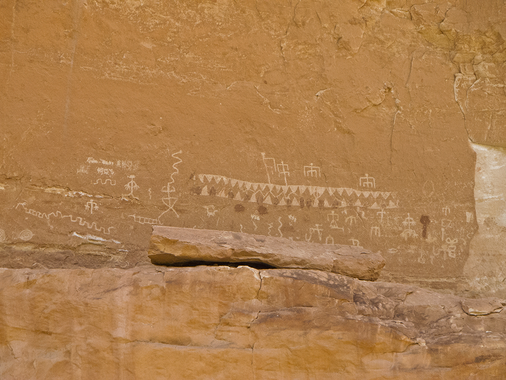
An unusually large and odd shaped boulder on top of a promontory on the left side of the canyon appears at 2.1 miles. It’s called “The Shoe,” and as the trail loops around it look for a panel of petroglyphs high on the left wall of the canyon. It has a number of figures and symbols, including a long series of triangles with their points facing down and another series under them with the points facing up. There are also quite a few “anthropomorphs,” rock art lingo for human-like figures. On the left side of the panel, spirals are pecked into the rock, symbols that may have represented migration of early inhabitants.
A couple of meanders later, the trail climbs up to a broad sandstone ledge and stays on it around a large south-facing cliff with an alcove high above. It then goes left around another promontory, and after a couple hundred feet Owachomo Bridge comes into view.
Owachomo Bridge
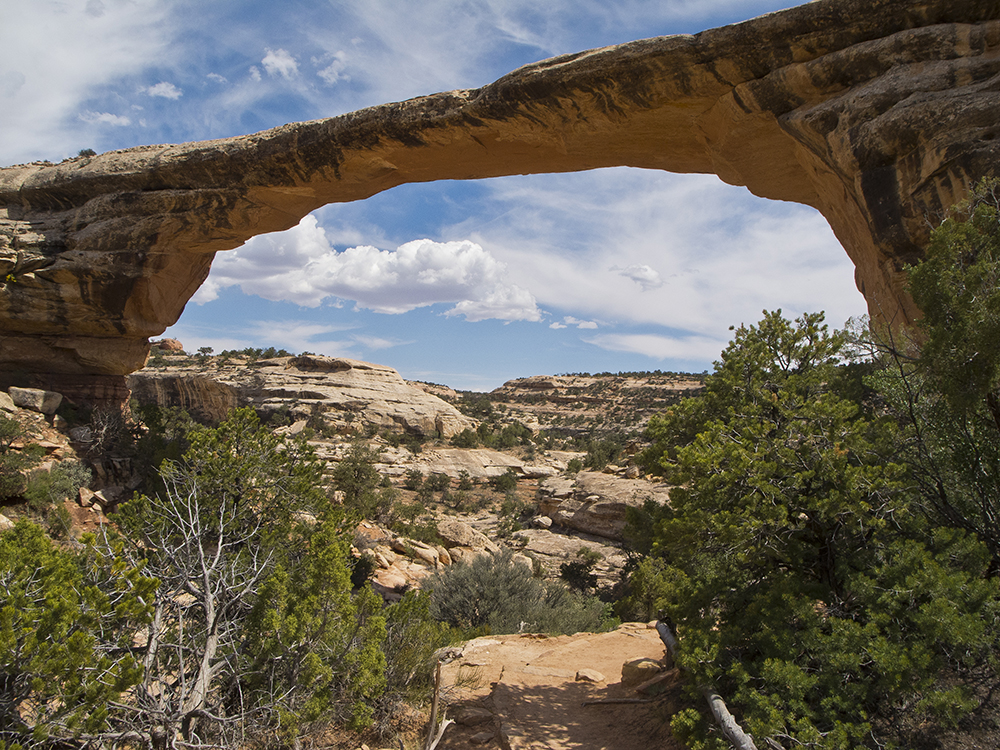
Owachomo, which means “rock mound” in the Hopi language, is named for a wind-sculpted hump of rock at the eastern end of the bridge. The bridge itself is 180 feet wide and 106 feet tall. As the most eroded bridge (it is the narrowest and most delicate), it is probably the oldest. Also notice that no stream flows underneath, which is unusual since the difference between a natural bridge and an arch is that a bridge is created by a stream. In this case, Tuwa Creek did make the bridge, but subsequently cut through the neck of a nearby meander and established a new channel that bypasses Owachomo.
After feasting your eyes on this elegant sweep of sandstone against the sky and pondering the remarkable congruence of events (and time) it takes to create such a natural feature, you climb out of the canyon up a long slope with ledges of sandstone and pockets of cryptobiotic soils. As you climb, look across the canyon to see the remains of the road that was the original entrance to the monument.
On the mesa
After reaching the overlook and parking lot, you cross the highway where the trail passes a sign that gives the various distances for the mesa top trails. It continues climbing a slight ridge among junipers, piñons, and scattered sagebrush and Mormon tea. On the eastern skyline you can see the Bears Ears, two buttes that are a well-known landmark. After a couple hundred yards, the trail crosses the road and drops into a broad basin. After crossing the streambed, it climbs back to the top of the sandstone cap rock, with the assistance of a short ladder. The large mesa to the south is named Moss Back Butte.
In 0.4 mile, the trail reaches the road again; here you can return to the parking lot by walking along the edge of the road (0.9 mile) or cross the road and take the trail to a junction where you can go left to return to the parking lot (1.3 miles). Although taking the trail is longer, you won’t have cars whizzing by.
Directions to the trailhead
From Blanding, take US Highway 191 south 4 miles to UT 95, turn right and drive for 37 miles to the national monument. Turn north to reach the park visitor center, and from there drive 4.9 miles on Bridge View Drive to the parking lot for Kachina Bridge. The trail begins next to the restroom.
General Location Natural Bridges National Monument
Distance 5.5 miles (8.9 km)
Difficulty Strenuous
Highest/Lowest Elevation 6,170/5,680 ft (1,880/1,731 m)
Fees Park entrance fee required. Check the website below for current information
Pets Not Allowed
More Info NPS website
Adventure awaits
Sign up to get monthly hikes in your inbox for a year.

Special membership offer
Join the Grand Canyon Trust today to receive your adventure kit:
- $25 donation: a Grand Canyon map, The Advocate magazine subscription, bookmark, and sticker
- $75 donation: everything above plus four stunning note cards
- $100 donation: all the benefits of the $75 level, plus a Grand Canyon Trust hat
Related Hikes by Destination
Sites: 25
Season: Open year-round
Reservations: For groups sites only
Distance: 8 mi (12.9 km)
Difficulty: Easy
Type: Out and back
State: Utah
Nearest Town: Springdale, Utah
Distance: 2.2 mi (3.5 km)
Difficulty: Moderate
Type: Out and back
