Colorado Plateau Explorer
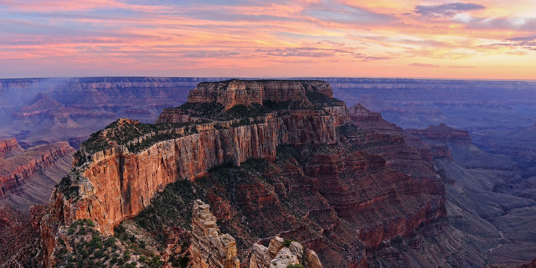
Plan a trip, take a hike, and experience the Colorado Plateau!
Distance: Up to 13 miles
Difficulty: Easy
Type: Point-to-point
Distance: 6.6 miles (10.6 km) one way
Difficulty: Moderate
Type: Out and back
Distance: 9.5 miles (15.3 km)
Difficulty: Strenuous
Type: One way
Distance: 27.9 miles
Difficulty: Strenuous
Type: Out and back
Distance: 3.4 miles (5.5 km)
Difficulty: Moderate
Type: Out and back
Distance: 2.6 miles (4 km)
Difficulty: Moderate
Type: Out and back
Distance: 25.9 mi (41.68 km)
Difficulty: Strenuous
Type: Point to point
Distance: 9 miles (14.5 km)
Difficulty: Moderate
Type: Out and back
Distance: 9.5 miles (15.3 km)
Difficulty: Strenuous
Type: Out and back
Distance: 12.4 miles (20 km)
Difficulty: Strenuous
Type: Loop hike
Distance: 9.4 miles (15 km)
Difficulty: Moderate
Type: Out and back
Distance: 15.6 miles (25.1 km)
Difficulty: Strenuous
Type: Loop hike
Distance: 3.2 miles (5.1 km)
Difficulty: Moderate
Type: Out and back
Distance: 5 miles (8 km)
Difficulty: Strenuous
Type: Out and back
Distance: 3.4 miles (5.5 km)
Difficulty: Easy
Type: Out and back
Distance: 10.8 miles (17.3 km)
Difficulty: Strenuous
Type: One way
Distance: 10.2 miles (16.4 km)
Difficulty: Strenuous
Type: Out and back
Distance: 1.6 miles (2.5 km)
Difficulty: Easy
Type: Out and back
Grand Canyon Conservation Support the Trust and protect the Grand Canyon
Your donation funds on-the-ground conservation efforts and advocacy work.