Don’t let the circus of goblins spook you on the Goblin Valley Trails
Hike in Goblin Valley State Park’s otherworldly landscape.
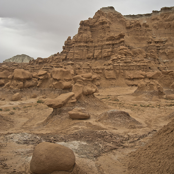
The Entrada Canyon Trail follows an intricate drainage system northwest to the park campground. You immediately drop into the canyon, and though the walls never exceed 15 or 20 feet in height, they block all views of the surrounding area. The canyon parallels the road leading to the trailhead, so you may hear cars nearby. For the next mile, you wind through a fragile Entrada Sandstone canyon that is weathering away into hoodoos called “goblins” here.
Millions of years ago, ocean waters covered what is now southeastern Utah, creating an inland sea in what we know as Goblin Valley. Sediments from surrounding highlands flowed into the sea and redeposited in layers of siltstone, shale, and sandstone, forming the Entrada Sandstone you’re hiking through today. As you hike through the canyon, take time to investigate the occasional unearthly rock formations, stained to a rusty tint by iron oxide.
Just short of one mile, you follow a drainage out of the canyon and reach a junction with a park service road. Turn left towards the Curtis Bench Trail (the park campground is a half mile straight ahead).
Panoramic views along Curtis Bench
Vast views of the San Rafael Swell stretch before you to the north. The pale, slanted ridge forms the eastern edge of the Swell, and the crimson table ahead of you is Wildhorse Butte.
Following the service road, you see several solar panels and a building on the right side of the road, the infrastructure for the park’s photovoltaic system. Goblin Valley State Park is completely off the grid, getting all its power and pumping its water from the electricity generated by these panels.
At one mile, you arrive at a signed junction for the Curtis Bench Trail. Turn left, heading south along the trail towards the Henry Mountains that now rise ahead of you.
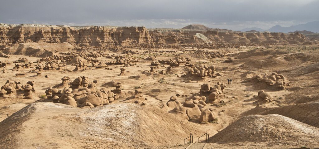
Continuing down the trail, you can spot the parking lot to your left and the troops of strange-shaped hoodoos ahead of you that give Goblin Valley its name. Around 1.5 miles, you reach a spur trail that heads left to the Valley of Goblins. You will take this on your return trip, but first veer right at this junction towards the Curtis Bench viewpoint. A quarter mile ahead, you reach a wooden post that marks the end of the trail. From here, return to the last junction and turn right, heading into a maze of drainages that eventually puts you in the heart of Goblin Valley.
Find your way: labyrinth of drainages into Goblin Valley
More of a route than a trail, this section of the hike can be confusing. Start by following the drainage; when you reach a junction with another wash, you should find a post with an arrow that indicates the direction of travel. Unmarked junctions involve guesswork, but as long as you continue heading down the drainage, you will eventually end up at the bottom of the valley.
If you’ve followed the correct route through the maze, you arrive at a post with two arrows near 2.5 miles — one points straight, the other one right. From here, Goblin Valley is straight in front of you with the fantastical hoodoos beckoning you to explore the valley on your way back to the trailhead. Or, you can opt to turn right and continue farther down the wash. Doing so simply adds mileage, since you will eventually cut east into Goblin Valley for your return route.
Return through a circus of hoodoos
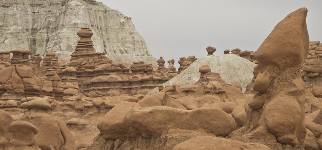
When you finally find yourself amongst the goblins, the fun really begins. Wander through the alien landscape, playing hide-and-seek or exploring the rock formations.
Goblin Valley is made up mostly of Entrada Sandstone. Time, water, and wind have differentially eroded the layers of rock that make up the Entrada. The softer siltstone and shale layers erode more easily than the harder underlying sandstone. Certain joints and fissures in the rock are more susceptible to erosion. Over time, weathering carves and polishes the exposed sandstone into bulbous caps, which protect the softer bases of the hoodoos.
Spend as long as you like meandering in the valley, but when you want to return, look to the north for the pavilion near the parking lot. Use this as a reference point to make your way back to the trailhead.
Directions to the park
From Hanksville, Utah, drive 19.5 miles north on UT 24. Just past mile marker 136, turn left onto Temple Mountain Road, following the sign towards I-70, Goblin Valley, and Temple Mountain. Drive 5 miles along this road before reaching the turnoff to Goblin Valley State Park, Bell, and Little Wild Horse Canyons. Reset your odometer, and turn left at the junction. About 6.5 miles down this road, you arrive at the state park visitor center and pay station. Continue straight ahead, and turn left at the stop sign towards the Valley of Goblins. Follow the winding road for just over a half mile before arriving at a large parking lot and picnic area. The Entrada Canyon Trail is marked with a small sign and begins on the west side of the parking lot, behind the pit toilets.
General Location Goblin Valley State Park
Distance 4.3 miles (6.9 km)
Difficulty Moderate
Trailhead Elevation 4,950 ft (1,492 m)
Highest/Lowest Elevation 5,000/4,850 ft (1,524/1,478 m)
Fees Fee required – Check the website listed below for current information.
More Info Goblin Valley State Park website
Adventure awaits
Sign up to get three hikes in your inbox every month for a year.

Special membership offer
Join the Grand Canyon Trust today to receive your adventure kit:
- $25 donation: a Grand Canyon map, The Advocate magazine subscription, bookmark, and sticker
- $75 donation: everything above plus four stunning note cards
- $100 donation: all the benefits of the $75 level, plus a Grand Canyon Trust hat
Related Hikes by Destination
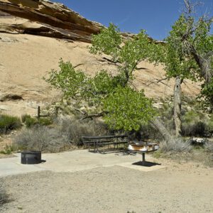
Sites: 25
Season: Open year-round
Reservations: For groups sites only
Distance: 8 mi (12.9 km)
Difficulty: Easy
Type: Out and back
State: Utah
Nearest Town: Springdale, Utah
Distance: 2.2 mi (3.5 km)
Difficulty: Moderate
Type: Out and back
